Dum Dum
| Dum Dum | |
|---|---|
| Neighbourhood in Kolkata (Calcutta) | |
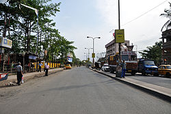 Jessore Road at Dum Dum | |
 Dum Dum Location in Kolkata | |
| Coordinates: 22°37′N 88°25′E / 22.62°N 88.42°E / 22.62; 88.42Coordinates: 22°37′N 88°25′E / 22.62°N 88.42°E / 22.62; 88.42 | |
| Country | |
| State | West Bengal |
| District | Kolkata |
| City | Kolkata |
| Area | |
| • Total | 9.23 km2 (3.56 sq mi) |
| Elevation | 11 m (36 ft) |
| Population (2011) | |
| • Total | 114,786 |
| • Density | 12,000/km2 (32,000/sq mi) |
| Languages | |
| • Official | Bengali, English |
| Time zone | UTC+5:30 (IST) |
| PIN | 700028, 700065, 700074, 700080 |
| Telephone/ STD code | +91 33 |
Lok Sabha constituency | Dum Dum |
Vidhan Sabha constituency | Dum Dum |
| Website | north24parganas.nic.in |
Dum Dum is a city with a municipality in Barrackpore subdivision of North 24 Parganas district in the state of West Bengal. It is a part of Kolkata Urban Agglomeration.
Contents
1 Etymology
2 History
3 Geography
3.1 Location
3.2 Police station
3.3 Post Offices
4 Demographics
4.1 Population
4.2 Kolkata Urban Agglomeration
5 Economy
5.1 Industry
5.2 Infrastructure
5.3 KMDA
6 Transport
6.1 Travel within Dum Dum
7 Education
8 Healthcare
9 See also
10 References
11 External links
Etymology
During the 19th century the area was home to the Dum Dum Arsenal, a British Royal Artillery armoury, where, in the early 1890s, Captain Neville Bertie-Clay developed a bullet with the jacket cut away at the tip to reveal its soft lead core (see hollow-point bullet), known informally as a dum-dum,[1][2][3][4][5][6][7] or more correctly as an expanding bullet. The previous name of Dumdum was "Domdoma".
History
Dum Dum was sparsely populated before the British came. The area was slightly elevated. On 6 February 1757, an accord was signed at Dum Dum by the Nawab of Bengal to allow the British to build forts at Calcutta, Dacca and Kashim Bazar. In 1783 a cantonment was established at Dum Dum. Military barracks were built and civilians started coming in to provide essential services to the military personnel. A Cantonment Board was formed to provide civic amenities. The ordnance factory was established at Dum Dum in 1846. It may be noted that both North Dumdum municipality and South Dumdum municipality were established in 1870 thereby somewhat defining administratively the different parts of an earlier undefined Dum Dum "area".[8][9][10][11]
Dum Dum was a separate subdivision for a short period. (See Barrackpore subdivision for more information). During the early years of the cantonment the British waged several imperial wars, out of which the wars in Burma, Nepal, the Deccan and Afganisthan were costly in blood and lives. Two monuments were erected to commemorate their memory. During the 1857 disturbances the Indian sepoys posted at Dum Dum were affected, and Mangal Pandey was hanged from a tree at Dum Dum cantonment (he/ his dead body was probably hanged at both Barrackpore and Dum Dum). Dum Dum cantonment was closed down and the Cantonment Board was replaced by Dum Dum Municipality in 1929. The temporary set back to Dum Dum arising from abolition of the cantonment and departure of British troops, was partially made up with the shifting of Jessop & Co. from Howrah to Dum Dum in 1928 and establishment of the Gramophone Company at Dum Dum in 1929. Bengal Flying Club, established in 1920, had a small fleet of single engine moth planes. The independence movement led to the sudden development of the Central Jail, where many top leaders and more numerous unknown patriots were lodged. The old military barracks made way for multi-storied jail barracks. The environment quite often reverberated with the chanting of Vande Mataram.[8]
With the partition of Bengal in 1947, "millions of refugees poured in from erstwhile East Pakistan."[12] In the initial stages bulk of the refugees were non-agriculturists. A few of them made their own arrangements, but "it was squatters who made the East Bengali refugees famous or infamous." Squatting (jabardakhal in Bengali) ranged from the forcible occupation of barracks to the collective take-over of private, government and waste land. "This happened as early as 1948 with middle class refugees in the Jadavpur area: first on government land and then on private property, leading to violent clashes. Having won the battle, the elated squatters named their colony ‘Bijaygarh’, the Fort of Victory." By 1949, there were 40 such colonies in Jadavpur, Kasba, Santoshpur, Garia and Behala, in the south-eastern part of the city, and 65 in the Dum Dum and Panihati zone in the north. Subsequently squatters colonies also came up along the west bank of the Hooghly and by 1950, there were 150 such colonies. It has to be borne in mind that the squatters were in a way "self-settlers" in the absence of adequate official arrangements for rehabilitation. Within a very short time the refugees (quite often with government/ administrative support) not only found a place to stay but developed a society with markets, schools, temples and sometimes even colleges, hospitals and recreational centres.[13][14] Efforts have been made in more recent years to regularise land/property rights in the refugee colonies.[15][16][17][18]
Geography
 [Full screen] |
Cities and towns in the southern portion of Barrackpore subdivision in North 24 Parganas district M: municipal city/ town, CT: census town, N: neighbourhood/ administrative location Owing to space constraints in the small map, the actual locations in a larger map may vary slightly |
Location
Dum Dum is located at 22°37′N 88°25′E / 22.62°N 88.42°E / 22.62; 88.42.[19] It has an average elevation of 11 metres (36 feet).
Dum Dum is bounded by North Dumdum (municipality) on the north and a part of the west, Rajarhat CD Block on the east, and South Dumdum (municipality) on the south and a part of the west.[20]
96% of the population of Barrackpore subdivision (partly presented in the map alongside, all places marked on the map are linked in the full screen map) lives in urban areas. In 2011, it had a density of population of 10,967 per km2 The subdivision has 16 municipalities and 24 census towns.[21]
For most of the cities/ towns information regarding density of population is available in the Infobox. Population data is not available for neighbourhoods. It is available for the entire municipal area and thereafter ward-wise.
Police station
Dum Dum police station under Barrackpore Police Commissionerate has jurisdiction over Dum Dum and South Dumdum municipal areas.[22][23]
Post Offices
Dum Dum has a delivery sub post office, with PIN 700028 in the Kolkata North Division of Kolkata district in Calcutta region. Other post offices with the same PIN are Rajabagan, Jugipara Satganchi, Kamalpur, Kumarpara, Nagerbazar and Ordnance Factory.[24][25]
Durganagar has a non-delivery sub post office, with PIN 700065 in the Kolkata North Division of Kolkata district in Calcutta region. Other post offices with the same PIN are Subhas Nagar, Rabindra Nagar and Health Institute.[26]
Motijheel has a delivery sub post office, with PIN 700074 in the Kolkata North Division of Kolkata district in Calcutta region. Other post offices with the same PIN are Dum Dum Road and Jawpore.[27]
Jessore Road has a non-delivery sub post office, with PIN 700080 in the Kolkata North Division of Kolkata district in Calcutta region. The only other post office with the same PIN is Mall Road.[28]
Demographics
Population
| Population of Dum Dum | |||
|---|---|---|---|
| Census | Pop. | %± | |
| 1931 | 5,350 | — | |
| 1941 | 7,622 | 42.5% | |
| 1951 | 14,002 | 83.7% | |
| 1961 | 20,041 | 43.1% | |
| 1971 | 31,363 | 56.5% | |
| 1981 | 33,604 | 7.1% | |
| 1991 | 40,961 | 21.9% | |
| 2001 | 101,296 | 147.3% | |
| 2011 | 114,786 | 13.3% | |
| Source:[29] | |||
As per the 2011 Census of India, Dum Dum had a total population of 114,786, of which 58,566 (51%) were males and 56,220 (49%) were females. Population below 6 years was 8,259. The total number of literates in Dum Dum was 97,997 (91.99% of the population over 6 years).
[30]
As of 2001 India census,[31] Dumdum had a population of 102,319. Males constitute 52% of the population and females 48%. Dumdum has an average literacy rate of 82%, higher than the national average of 59.5%: male literacy is 85% and, female literacy is 78%. In Dumdum, 8% of the population is under 6 years of age.
Kolkata Urban Agglomeration
The following Municipalities, Census Towns and other locations in Barrackpore subdivision were part of Kolkata Urban Agglomeration in the 2011 census: Kanchrapara (M), Jetia (CT), Halisahar (M), Balibhara (CT), Naihati (M), Bhatpara (M), Kaugachhi (CT), Garshyamnagar (CT), Garulia (M), Ichhapur Defence Estate (CT), North Barrackpur (M), Barrackpur Cantonment (CB), Barrackpore (M), Jafarpur (CT), Ruiya (CT), Titagarh (M), Khardaha (M), Bandipur (CT), Panihati (M), Muragachha (CT) New Barrackpore (M), Chandpur (CT), Talbandha (CT), Patulia (CT), Kamarhati (M), Baranagar (M), South Dumdum (M), North Dumdum (M), Dum Dum (M), Noapara (CT), Babanpur (CT), Teghari (CT), Nanna (OG), Chakla (OG), Srotribati (OG) and Panpur (OG).[32]
Economy
Industry
The following industrial units are located in Dum Dum:
Ordnance Factory Dum Dum is a modern factory with unique high precision machining system such as Laser Cutting Machine, CNC operated Injection Moulding Machine and CNC Machines for carrying out stringent quality products. The factory was initiated when Robert Clive recaptured Calcutta from Siraj ud-Daulah, the Nawab of Bengal, in 1757. It became the first development centre for defence stores in India established by the Royal forces. When the Gun & Shell Factory was established at Cossipore it worked in tandem with the Gun & Shell Factory. After the disastrous First Anglo-Afghan War, the first Ammunition Factory in British India was set up here. It produced the dumdum bullets. The 1857 mutiny was sparked by inputs from this factory. The site was also used as a jail and many freedom fighters were hung here. Hearsay includes the Santal leader Kanhu Murmu. The Ammunition Factory was shifted to Pune in 1869, but the ordnance factory continued to function at Dum Dum.[33]
Jessop & Company, located at Dum Dum, is a leading engineering company since 1788, when Breen & Company was founded in Calcutta. In 1820, Henry and George, sons of William Jessop, acquired, on behalf of Butterley Company, Breen & Company. Butterley Company was founded in Derbyshire, England. Butterley Company and Breen & Company merged to form Jessop & Company in 1820. The company was a pioneer in the engineering field and had many feathers in its cap. During 1815-40 it built the first iron bridge (loha-ka-pul) in India, across the Gomti at Lucknow. It floated the first steam boat in Indian waters in 1819, manufactured the first steam roller for Indian roads in 1890, and produced the first electrical multiple unit (EMU) coach for Indian railways in 1959. In 1973, the company was taken over by the Government of India and in 1986, it became a subsidiary of the holding company Bharat Bhari Udyog Nigam.[34][35] In 2003, as part of the strategic disinvestment of the NDA government, the Kolkata-based Ruia Group, headed by Pawan Kumar Ruia, took charge of loss-making Jessop.[36] Pawan Kumar Ruia has successfully turned around Jessop.[37]

The original painting "His Master's Voice" was made in 1899.
- The Dum Dum recording studio of Saregama, a part of the factory with production facilities, was established in 1928. It holds "around 30,000 master tapes of original Indian music recorded by the company since Gauhar Jaan sang raga Jogiya in Kolkata and became the first Indian voice to be recorded on shellac disc in 1902." In the studio "text and photographs of artistes from Hindustani and Carnatic classical, Hindi and south Indian playback, devotional and Bengali music, who have recorded with the company, are also exhibited along with a copy of the original agreement that Tagore signed with the company before cutting his first musical record at the Dum Dum studio in 1928." The tapes are in at least 19 major Indian languages. The collection includes speeches of Mahatma Gandhi, Jawaharlal Nehru and Subhas Chandra Bose. In the world of music the list is too long for elaboration here but it includes the voice of Kazi Nazrul Islam. It is a simple, "You name it and it is there." Saregama of the RP-Sanjiv Goenka Group under the chairmanship of Sanjiv Goenka, were the successors to the Gramaphone Company of India (possibly better known for their His Master’s Voice or HMV logo) was among the first overseas branches of the British record firm, Electric and Music Industries (EMI).[38]
Infrastructure
As per the District Census Handbook 2011, Dum Dum municipal city covered an area of 9.23 km2. Amongst the civic amenities it had open drains. Amongst the medical facilities It had 13 medicine shops. Amongst the educational facilities it had 31 primary schools, 10 secondary schools, 19 senior secondary schools, 1 degree college for arts/science/commerce and 77 non-formal education centres. Amongst the social, recreational and cultural facilities it had 10 auditorium/ community halls, 11 public libraries and 1 reading room. Amongst the commodities manufactured were rail wagons, gun and shell, and music CD. It had 6 bank branches.[39]
See also Cities and towns in Barrackpore subdivision
KMDA
Dum Dum municipality is included in the Kolkata Metropolitan Area for which the KMDA is the statutory planning and development authority.[40][41]
Transport
Dum Dum Cantonment and Durganagar railway stations are on the Sealdah-Bangaon line.[42]Dum Dum Junction railway station and Dum Dum metro station are in South Dumdum but are easily approachable from all parts of Dum Dum.[43]
NH 12 (previously NH 34) running from Dalkhola to Bakkhali, locally popular as Jessore Road, passes through Dum Dum.[44][43]
Buses ply both arterial roads: the Jessore Road and the Dum Dum Road. On Dum Dum Road the bus routes are 30B [Babughat-Gauripur], 202 [Nagerbazar-Science City], DN9 [Chapadali-[Dakshineswar]], Howrah-Nagerbazar Mini, Dankuni-Nagerbazar WBSTC, Rajchandrapur-Salt Lake white bus, S10 [Airport Gate No.1- Nabanna]. On Jessore road there are more routes: 3C/1 [Nagerbazar- Anandapur via APC Road], 3C/2 [Nagerbazae Anandapur via Bidhan Sarani], 30C, 30D [Dum Dum Cantt- Babughat], 30E, 45, 45A, 45B, 47, 47A, 47B, 79B [Barasat-Bagbazar], 91, 91A, 91B, 93, 211A, 215, 215/1, 219, 219/1, 221, 223, KB16, DN8, DN18, Bagbazar-Birohi, S-13, R.G.Kar-Barasat. The minor roads on which buses ply are R.N. Guha Road (30B/1), Birati-Nimta road (237), Laketown connector (221, 223, 30C, 211A, 47, 47A), and Gorabazar-Cantonment Road (30D).
Travel within Dum Dum
There are a plenty of blue and private taxis, and mini-buses buses available, as well as a few CSTC or WBSTC or CTC buses.
Autos are plentiful and can be used for short stretches, for example to travel from Dum Dum Station to Nagerbazar, or Dum Dum Station to Chiriamore.
Nagerbazar is the hub of autos where there are 4 routes originates viz:
1) Nagerbazar Dum Dum Junction
2) Nagerbazar Dum Dum Cantt
3) Nagerbazar Airport 1 no. gate
4) Nagerbazar Laketown-Jessore Road Connector
In addition, there are taxis: Nagerbazar and Airport being the largest taxi stands; others are in Birati, Central Jail, Laketown, Bangur, and Kalindi. The Dum Dum Station area does not have many taxis as the area is extremely crowded. The other popular means of travel over short distances is the rickshaw, newly battery operated rickshaws [locally called Totos] can also be seen.
Education
The following colleges are located in Dum Dum:
Dum Dum Motijheel College was established at Dum Dum in 1950. The college runs in two shifts. The women’s section has classes in the morning and the coeducational section has classes during the day. The day section offers honours courses in Bengali, English, economics, education, history, human development, journalism & mass communication, philosophy, political science, sociology, botany, chemistry, computer science, geography, mathematics, micro biology, physics and zoology. The morning section offers honours courses in Bengali, English, education, economics, history, human development, journalism & mass communication, philosophy, political science, sociology, botany, chemistry, computer science, geography, mathematics, microbiology and physics. The college has a post graduate unit in M.Sc. mathematics and M.A. English. It offers a vocational course in instrumentation.[45][46]
Dum Dum Motijheel Rabindra Mahavidyalaya was established at Dum Dum in 1968.It was started as an evening college in commerce, became a day college in commerce in 1974 and finally a general day college, with arts, science, and commerce courses, in 2004. It offers B.Com (Hons) in marketing, geography honours in B.Sc. and Journalism honours in B.A.[47][48]
Sarojini Naidu College for Women was established at Dum Dum in 1956. It offers honours courses in Bengali, English, Sanskrit, geography, history, philosophy, political science, economics, botany, chemistry, mathematics, philosophy, zoology and anthropology.[49][50]
Ramakrishna Sarada Mission Vivekananda Vidyabhavan was established by Ramakrishna Sarada Mission at Dum Dum in 1961.It is a partly residential college for women. It offers honours courses in Bengali, English, Sanskrit, education, history, philosophy, political science, economics, sociology, journalism & mass communication, economics and geography.[51][52]
- Indian College of Arts and Draftsmanship, was established at Dum Dum in 1893. It offers courses in painting, applied arts, sculpture and graphics. It is affiliated with Rabindra Bharati University.[53]
The following schools are located in Dum Dum:
- Dum Dum Subhasnagar High School, at Subhasnagar, is a Bengali-medium school, boys only up to Class X and coeducational for the higher secondary classes. It was established in 1954.[54][55]
- Dum Dum Baidyanath School, at Harimohan Dutta Road, is a girls only Bengali-medium school.[56]
- Dum Dum Girls’ School, at UK Dutta Road, in Ward No. 20 of Dum Dum Municipality, is a girls only Bengali-medium higher secondary school. It has facilities for teaching in Classes VI to XII. It was established in 1951.[57][58]
Dum Dum Motijheel Girls' High School, at Dum Dum Road, is a girls’ high school.[59][60]
- Kendriya Vidyalaya Ordnance Factory Dum Dum was established in 1986, for the children of employees of the Ordnance Factory Dum Dum, defence personnel and other central government offices. It has arrangements for teaching from Classes I to XII. A co-educational day school, it functions under Kendriya Vidyalaya Sangthan and prepares students for CBSE examinations through Hindi and English mediums. The Vidyalaya offers free education up to Class VIII.[61][62]
- Dum Dum K.L.S. Hindi Vidyalaya, in Ward No. 19, Dum Dum Municipality, is a Hindi-medium co-educational higher secondary school run by the Department of Education, Government of West Bengal. Established in 1959, it has arrangements for teaching in Classes VI to XII.[63][64]
- Auxilium Convent School at Rajbari, Dum Dum, is an English-medium girls only school run by Salesian Sisters. Established in 1960, it prepares students for the ISC and ICSE examinations. Admission eligibility for LKG is 3 years age on 31 March.[65]
See also - North Dumdum and South Dumdum for more schools in the Dum Dum area
Healthcare
Dum Dum Municipal Specialised Hospital at 4 Hari Mohan Dutta Road, Dum Dum Cantonment, has been modernised and updated with the objective of offering treatment on par with the best medical facilities in Kolkata. It has 105 beds. It has experienced doctors (4 doctors are available round-the-clock), qualified nurses, technicians and staff. It specialises in pace-maker implantation, total knee replacement, spinal surgery and has cardiac ambulance facility.[66][67]
Dum Dum Central Jail Hospital functions with 100 beds.[66]
See also
- Dum Dum Arsenal
- Dum-dum bullets
- Dum-dum fever
- List of reduplicated place names
References
^ First world War
^ India 9
^ Encyclopedia
^ Specialist Ammunition Types
^ 303 British
^ BBC News
^ "Dum Dum". Encyclopædia Britannica. 2009. Retrieved 2009-05-18..mw-parser-output cite.citation{font-style:inherit}.mw-parser-output q{quotes:"""""""'""'"}.mw-parser-output code.cs1-code{color:inherit;background:inherit;border:inherit;padding:inherit}.mw-parser-output .cs1-lock-free a{background:url("//upload.wikimedia.org/wikipedia/commons/thumb/6/65/Lock-green.svg/9px-Lock-green.svg.png")no-repeat;background-position:right .1em center}.mw-parser-output .cs1-lock-limited a,.mw-parser-output .cs1-lock-registration a{background:url("//upload.wikimedia.org/wikipedia/commons/thumb/d/d6/Lock-gray-alt-2.svg/9px-Lock-gray-alt-2.svg.png")no-repeat;background-position:right .1em center}.mw-parser-output .cs1-lock-subscription a{background:url("//upload.wikimedia.org/wikipedia/commons/thumb/a/aa/Lock-red-alt-2.svg/9px-Lock-red-alt-2.svg.png")no-repeat;background-position:right .1em center}.mw-parser-output .cs1-subscription,.mw-parser-output .cs1-registration{color:#555}.mw-parser-output .cs1-subscription span,.mw-parser-output .cs1-registration span{border-bottom:1px dotted;cursor:help}.mw-parser-output .cs1-hidden-error{display:none;font-size:100%}.mw-parser-output .cs1-visible-error{font-size:100%}.mw-parser-output .cs1-subscription,.mw-parser-output .cs1-registration,.mw-parser-output .cs1-format{font-size:95%}.mw-parser-output .cs1-kern-left,.mw-parser-output .cs1-kern-wl-left{padding-left:0.2em}.mw-parser-output .cs1-kern-right,.mw-parser-output .cs1-kern-wl-right{padding-right:0.2em}
^ ab "Dum Dum Municipality". Chronicles of Dum Dum. DDM. Retrieved 20 July 2018.
^ "Ordnance Factory Dum Dum". History – Dum Dum Story. OFDD. Retrieved 20 July 2018.
^ "North Dum Dum municipality". About us. NDM. Retrieved 11 June 2018.
^ "South Dum Dum Municipality". Barrackpore administration. Retrieved 20 July 2018.
^ Chatterjee, Monideep, "Town Planning in Calcutta: Past, Present and Future", in "Calcutta, The Living City" Vol II, Edited by Sukanta Chaudhuri, Page 142, First published 1990, 2005 edition, ISBN 019 563697
^ Chatterjee, Nilanjana, "The East Bengal Refugees: A Lesson in Survival", in "Calcutta, The Living City" Vol II, Edited by Sukanta Chaudhuri, Pages 72-75, First published 1990, 2005 edition, ISBN 019 563697
^ Sen, Uditi. "The Myths Refugees Live By Memory and History of the Making of Bengali Refugee Identity". 2014, Page 48. Modern Asian Studies, 48, doi:10.1017/S0026749X12000613. Retrieved 5 March 2018.
^ "The Refugee City: Partition and Kolkata's Post-colonial landscape". Bangalnama, 31 August 2009. Retrieved 13 March 2018.
^ "Dilemas of Diaspora: Partition, Refugees and the Politics of 'Home'". Pablo Bose. academia.edu. Retrieved 13 March 2018.
^ "4m refugees entered West Bengal after 1971". Nirmalya Banerjee. The Times of India, 11 August 2000. Retrieved 13 March 2018.
^ "Civic tax net on colony plots". 30 July 2008. Retrieved 13 March 2018.
^ Falling Rain Genomics, Inc - Dum Dum
^ "District Census Handbook North Twenty Four Parganas, Census of India 2011, Series 20, Part XII A" (PDF). Map of Barrackpore II CD Block on Page 379. Directorate of Census Operations, West Bengal. Retrieved 19 July 2018.
^ "District Statistical Handbook". North 24 Parganas 2013, Tables 2.1, 2.2, 2.4b. Department of Statistics and Programme Implementation, Government of West Bengal. Retrieved 2 May 2018.
^ "District Statistical Handbook". North 24 Parganas 2013, Table 2.1. Department of Statistics and Programme Implementation, Government of West Bengal. Retrieved 11 June 2018.
^ "Barrackpore Police Commissionerate". List of Police Stations with telephone numbers. West Bengal Police. Retrieved 11 June 2018.
^ "Locate Post Offices". West Bengal. Postal Department. Retrieved 22 July 2018.
^ "Dum Dum PIN Code". pincodezip.in. Retrieved 22 July 2018.
^ "Durganagar PIN Code". pincodezip.in. Retrieved 22 July 2018.
^ "Motijheel PIN Code". pincodezip.in. Retrieved 22 July 2018.
^ "Jessore Road PIN Code". pincodezip.in. Retrieved 22 July 2018.
^ "District Census Handbook North Twenty Four Parganas, Census of India 2011, Series 20, Part XII A" (PDF). Section II Town Directory, Pages 781-783 Statement I: Growth History, Pages 799-803. Directorate of Census Operations V, West Bengal. Retrieved 11 June 2018.
^ "2011 Census – Primary Census Abstract Data Tables". West Bengal – District-wise. Registrar General and Census Commissioner, India. Retrieved 7 June 2018.
^ "Census of India 2001: Data from the 2001 Census, including cities, villages and towns (Provisional)". Census Commission of India. Archived from the original on 16 June 2004. Retrieved 1 November 2008.
^ "Provisional Population Totals, Census of India 2011" (PDF). Constituents of Urban Agglomeration Having Population Above 1 Lakh. Census of India 2011. Retrieved 7 June 2018.
^ "Ordnance Factory Dum Dum". Indian Ordnance Factories. Retrieved 20 July 2018.
^ "Welcome to Jessop & Co. Ltd". History. Jessop. Retrieved 20 July 2018.
^ "Jessop & Co. Ltd., Kolkata" (PDF). Jessop. Retrieved 20 July 2018.
^ Sen, Elora. "Jessop Rebuilding History". India Today, 15 October 2009. Retrieved 20 July 2018.
^ "How Ruia turned Jessop around". Source: Business Standard. Rediff.com 26 November 2005. Retrieved 20 July 2018.
^ Bag, Shamik. "The house of vinyl". Kolkata Chromosome. live mint, 23 September 2010. Retrieved 20 July 2018.
^ "District Census Handbook North Twenty Four Parganas, Census of India 2011, Series 20, Part XII A" (PDF). Section II Town Directory, Pages 781-783 Statement I: Growth History, Pages 799-803; Statement II: Physical Aspects and Location of Towns, Pages 791-794; Statement III: Civic and other Amenities, Pages 795-796; Statement IV: Medical Facilities 2009, Pages 803-805 Section: Educational, Recreational and Cultural Facilities. Directorate of Census Operations V, West Bengal. Retrieved 31 May 2018.
^ "Kolkata Metropolitan Development Authoity, Annual Report 2010-11". 1/1 Kolkata Metropolitan Area Map. KMDA. Retrieved 7 June 2018.
^ "Kolkata Metropolitan Development Authority, Annual Report 2010-11". 1 / 2 Role of KMDA. KMDA. Retrieved 7 June 2018.
^ "33811 Seldah Bangaon Local". Time Table. indiarailinfo. Retrieved 26 May 2018.
^ ab Google maps
^ "Rationalisation of Numbering Systems of National Highways" (PDF). New Delhi: Department of Road Transport and Highways. Retrieved 16 September 2016.
^ "Dum Dum Motijheel College". DDMC. Retrieved 8 May 2018.
^ "Dum Dum Motijheel College". College Admission. Retrieved 8 May 2018.
^ "Dum Dum Motijheel Rabindra Mahavidyalaya". DDMRM. Retrieved 8 May 2018.
^ "Dum Dum Motijheel Rabindra Mahaviyalaya". College Admission. Retrieved 8 May 2018.
^ "Sarojini Naidu College for Women". SNCW. Retrieved 8 May 2018.
^ "Sarojini Naidu College for Women". College Admission. Retrieved 8 May 2018.
^ "Ramakrishna Sarada Mission Vivekananda Vidyabhaban". RSMVV. Retrieved 8 May 2018.
^ "Ramakrishna Sarada Mission Vivekananda Vidyabhaban". collegesdmission.in. Retrieved 8 May 2018.
^ Indian College of Arts and Draftsmanship
^ "Dum Dum Subhasnagar High School". Grotal. Retrieved 29 July 2018.
^ "Dum Dum Subhasnagar High School". Find Glocal. Retrieved 29 July 2018.
^ "Dum Dum Bidyanath Institution". Grotal. Retrieved 29 July 2018.
^ "Dum Dum Girls' High School". ICBSE. Retrieved 29 July 2018.
^ "Dum Dum Girls High School". Schools of Kolkata. Retrieved 29 July 2018.
^ "Dum Dum Motijheel Girls' High School". Grotal. Retrieved 29 July 2018.
^ "Dum Dum Motijheel Girls' High School". DDMHS. Retrieved 29 July 2018.
^ "Kendriya Vidyalaya Ordnance Factory Dum Dum". KDOFDD. Retrieved 29 July 2018.
^ "Kendriya Vidyalaya Ordnance Factory Dum Dum". schoolmykids. Retrieved 29 July 2018.
^ "Dum Dum K.L.S. Hindi Vidyalaya School". ICBSE. Retrieved 29 July 2018.
^ "West Bengal Council of Higher Secondary Education". WBCHSE. Retrieved 29 July 2018.
^ "Auxilium Convent School, Dum Dum". School Connects. Retrieved 29 July 2018.
^ ab "Health & Family Welfare Department". Health Statistics. Government of West Bengal. Retrieved 23 July 2018.
^ "Highlights of the Three Year Old". Dum Dum Municipal Specialised Hospital. Retrieved 20 July 2018.
External links
| Wikimedia Commons has media related to Dum Dum. |
 Kolkata/Northern fringes travel guide from Wikivoyage
- http://www.calcuttaairport.com/
Cities, towns, locations and neighbourhoods in North 24 Parganas district | |||||||||||
|---|---|---|---|---|---|---|---|---|---|---|---|
Municipal cities/ towns and Census towns |
| ||||||||||
| Locations other than cities and towns |
| ||||||||||
| Neighbourhoods of other cities and towns in North 24 Parganas |
| ||||||||||
| Related topics |
| ||||||||||


