St Lawrence, Queensland
St Lawrence Queensland | |||||||||||||||
|---|---|---|---|---|---|---|---|---|---|---|---|---|---|---|---|
 View along St Lawrence's main street | |||||||||||||||
 St Lawrence | |||||||||||||||
| Coordinates | 22°21′S 149°32′E / 22.350°S 149.533°E / -22.350; 149.533Coordinates: 22°21′S 149°32′E / 22.350°S 149.533°E / -22.350; 149.533 | ||||||||||||||
| Population | 396 (2011 census)[1] | ||||||||||||||
| Postcode(s) | 4707 | ||||||||||||||
| Elevation | 18 m (59 ft) | ||||||||||||||
| Location |
| ||||||||||||||
| LGA(s) | Isaac Region | ||||||||||||||
| State electorate(s) | Mirani | ||||||||||||||
| Federal Division(s) | Capricornia | ||||||||||||||
| |||||||||||||||
| |||||||||||||||
St Lawrence is a small town and locality in Queensland, Australia. It is part of the Isaac Region local government area.[2][3] In the 2011 census, St Lawrence had a population of 396 people.[1]
Contents
1 Geography
2 History
2.1 Heritage listings
3 Amenities
4 Education
5 Gallery
6 References
7 External links
Geography
St Lawrence is located 802 kilometres (498 mi) north of Brisbane and 6 kilometres (3.7 mi) off the Bruce Highway.The town is located south of St Lawrence Creek, which flows into a vast bay known as Broad Sound, a waterway noted for its large tidal range (up to 9 metres (30 ft) in the summer).
The North Coast railway line passes through the town, which is served by St Lawrence railway station.
History

Offices of the Isaac Regional Council (formerly Broadsound Shire Council Chambers), 2016
The township of St Lawrence was originally established to maintain the Customs Office for the Port of St Lawrence.[4]
The St Lawrence State School opened on 28 May 1871.[5]
The St Lawrence Library opened in 2001.[6]
At the 2006 census, St Lawrence and the surrounding area had a population of 195.[7]
St Lawrence was the administrative centre of the Shire of Broadsound until 2008, when the shire was amalgamated with the Shire of Belyando and the Shire of Nebo to form the Isaac Region local government area. Moranbah is the administrative centre of the new region but the former Broadsound Shire offices at 36 Macartney Street are still used as the local offices of the Isaac Regional Council.[8] The building was described in 2004 as "a disarmingly elegant building which seems quite out of place in this otherwise undistinguished town".[9]
Once a prosperous port town, exporting cattle from the hinterland, most residents are now railway workers.
Heritage listings
St Lawrence has a number of heritage-listed sites, including:
- Cannon Street: Christ Church Anglican Church[10]
- Macartney Street: St Lawrence Police Station[11]
- Settlement Road: Meatworks and Wharf Site[12]
Amenities
The Isaac Regional Council operates a public library at 22 Railway Parade.[13]
Education
St Lawrence State School is in Macartney Street. In 2015, it had an enrolment of 10 students with 2 teachers (1 equivalent full-time).[14] The school motto is 'Knowledge, Truth, Honesty'. [15]
Gallery

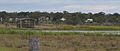
St Lawrence River - low tide
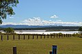
St Lawrence River - across the park
St Lawrence - Bird watching


References
^ ab Australian Bureau of Statistics (31 October 2012). "St Lawrence". 2011 Census QuickStats. Retrieved 30 December 2015..mw-parser-output cite.citation{font-style:inherit}.mw-parser-output .citation q{quotes:"""""""'""'"}.mw-parser-output .citation .cs1-lock-free a{background:url("//upload.wikimedia.org/wikipedia/commons/thumb/6/65/Lock-green.svg/9px-Lock-green.svg.png")no-repeat;background-position:right .1em center}.mw-parser-output .citation .cs1-lock-limited a,.mw-parser-output .citation .cs1-lock-registration a{background:url("//upload.wikimedia.org/wikipedia/commons/thumb/d/d6/Lock-gray-alt-2.svg/9px-Lock-gray-alt-2.svg.png")no-repeat;background-position:right .1em center}.mw-parser-output .citation .cs1-lock-subscription a{background:url("//upload.wikimedia.org/wikipedia/commons/thumb/a/aa/Lock-red-alt-2.svg/9px-Lock-red-alt-2.svg.png")no-repeat;background-position:right .1em center}.mw-parser-output .cs1-subscription,.mw-parser-output .cs1-registration{color:#555}.mw-parser-output .cs1-subscription span,.mw-parser-output .cs1-registration span{border-bottom:1px dotted;cursor:help}.mw-parser-output .cs1-ws-icon a{background:url("//upload.wikimedia.org/wikipedia/commons/thumb/4/4c/Wikisource-logo.svg/12px-Wikisource-logo.svg.png")no-repeat;background-position:right .1em center}.mw-parser-output code.cs1-code{color:inherit;background:inherit;border:inherit;padding:inherit}.mw-parser-output .cs1-hidden-error{display:none;font-size:100%}.mw-parser-output .cs1-visible-error{font-size:100%}.mw-parser-output .cs1-maint{display:none;color:#33aa33;margin-left:0.3em}.mw-parser-output .cs1-subscription,.mw-parser-output .cs1-registration,.mw-parser-output .cs1-format{font-size:95%}.mw-parser-output .cs1-kern-left,.mw-parser-output .cs1-kern-wl-left{padding-left:0.2em}.mw-parser-output .cs1-kern-right,.mw-parser-output .cs1-kern-wl-right{padding-right:0.2em}

^ "St Lawrence - town (entry 32101)". Queensland Place Names. Queensland Government. Retrieved 30 December 2015.
^ "St Lawrence - locality (entry 47035)". Queensland Place Names. Queensland Government. Retrieved 30 December 2015.
^ "St Lawrence - Isaac Regional Council". www.isaac.qld.gov.au. Retrieved 2015-12-30.
^ Queensland Family History Society (2010), Queensland schools past and present (Version 1.01 ed.), Queensland Family History Society, ISBN 978-1-921171-26-0
^ "Queensland Public Libraries Statistical Bulletin" (PDF). Public Libraries Connect. State Library of Queensland. November 2017. p. 13. Retrieved 26 January 2018.
^ Australian Bureau of Statistics (25 October 2007). "St Lawrence (Broadsound Shire) (State Suburb)". 2006 Census QuickStats. Retrieved 25 July 2009.
^ "Contact Us - Isaac Regional Council". www.isaac.qld.gov.au. Retrieved 2015-12-30.
^ "St Lawrence". Sydney Morning Herald. 8 February 2004. Retrieved 27 July 2016.
^ "Christ Church Anglican Church (entry 601661)". Queensland Heritage Register. Queensland Heritage Council. Retrieved 10 July 2013.
^ "Police Station and former Courthouse and Cell Block (entry 601152)". Queensland Heritage Register. Queensland Heritage Council. Retrieved 10 July 2013.
^ "Meatworks and Wharf Site (former) (entry 601173)". Queensland Heritage Register. Queensland Heritage Council. Retrieved 10 July 2013.
^ "St Lawrence Library". Public Libraries Connect. State Library of Queensland. 21 June 2017. Retrieved 26 January 2018.
^ "2015 School Annual Report" (PDF). St Lawrence State School. Retrieved 27 July 2016.
^ "St Lawrence State School". Education Queensland. Retrieved 2 February 2017.
External links
- University of Queensland: Queensland Places: St Lawrence
- BOM : Summary statistics : ST LAWRENCE POST OFFICE


