Isaac Region
Isaac Region Queensland | |||||||||||||||
|---|---|---|---|---|---|---|---|---|---|---|---|---|---|---|---|
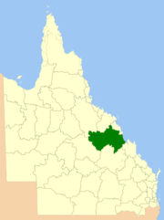 Location within Queensland | |||||||||||||||
| Population | 20,940 (2016)[1] | ||||||||||||||
| • Density | 0.35574730.35575/km2 (0.92138140.92138/sq mi) | ||||||||||||||
| Established | 2008 | ||||||||||||||
| Area | 58,862 km2 (22,726.7 sq mi) | ||||||||||||||
| Mayor | Anne Baker | ||||||||||||||
| Council seat | Moranbah | ||||||||||||||
| State electorate(s) |
| ||||||||||||||
| Federal Division(s) | Capricornia | ||||||||||||||
| Website | Isaac Region | ||||||||||||||
| |||||||||||||||
The Isaac Region is a local government area located in Central Queensland, Queensland, Australia created in March 2008 as a result of the report of the Local Government Reform Commission released in July 2007.
Contents
1 History
2 Towns and localities
3 Libraries
4 Mayors
5 Population
6 References
7 External links
History
Prior to 2008, the Isaac Region was an entire area of three previous and distinct local government areas:
- the Shire of Belyando;
- the Shire of Broadsound;
- and the Shire of Nebo.
The report recommended that the new local government area should not be divided into wards and elect eight councillors and a mayor. The Isaac Regional Council covers an area of 58,862 square kilometres (22,727 sq mi), contain an estimated resident population in 2006 of 20,443 and have an operating budget of A$46.0m.
The region takes its name from the Isaac River which in turn takes its name from Queensland pioneer Frederick Isaac who accompanied the explorer Ludwig Leichhardt on his first expedition.[2]
Towns and localities
The Isaac Region includes the following settlements:
Belyando area:
| Broadsound area:
| Nebo area:
|
* - The former town of Blair Athol, obliterated by the Blair Athol coal mine was within the region.[3]
Libraries
Isaac Regional Council operates public libraries in Carmila, Clermont, Dysart, Glenden, Middlemount, Moranbah, Nebo, and St Lawrence.[4]
Mayors
- 2008-2012: Cedric Marshall[5]
- 2012–2016: Anne Baker[6]
- 2016– : Anne Baker[7]
Population
The populations given relate to the component entities prior to 2008.
| Year | Total Region | Belyando | Broadsound | Nebo |
|---|---|---|---|---|
| 1933 | 4,971 | 2,987 | 1,590 | 394 |
| 1947 | 5,016 | 3,067 | 1,415 | 534 |
| 1954 | 5,088 | 3,104 | 1,537 | 447 |
| 1961 | 5,367 | 3,253 | 1,539 | 575 |
| 1966 | 5,101 | 2,997 | 1,625 | 479 |
| 1971 | 7,200 | 4,834 | 1,589 | 777 |
| 1976 | 11,389 | 7,210 | 3,379 | 800 |
| 1981 | 15,522 | 7,700 | 6,908 | 914 |
| 1986 | 22,133 | 11,362 | 8,419 | 2,352 |
| 1991 | 22,188 | 11,082 | 8,472 | 2,634 |
| 1996 | 20,703 | 10,755 | 7,486 | 2,462 |
| 2001 | 19,013 | 9,883 | 6,601 | 2,529 |
| 2006 | 19,820 | 10,455 | 6,843 | 2,522 |
| 2016 | 20,940 |
References
^ "3218.0 – Regional Population Growth, Australia, 2014–15". Australian Bureau of Statistics. Retrieved 29 September 2016..mw-parser-output cite.citation{font-style:inherit}.mw-parser-output .citation q{quotes:"""""""'""'"}.mw-parser-output .citation .cs1-lock-free a{background:url("//upload.wikimedia.org/wikipedia/commons/thumb/6/65/Lock-green.svg/9px-Lock-green.svg.png")no-repeat;background-position:right .1em center}.mw-parser-output .citation .cs1-lock-limited a,.mw-parser-output .citation .cs1-lock-registration a{background:url("//upload.wikimedia.org/wikipedia/commons/thumb/d/d6/Lock-gray-alt-2.svg/9px-Lock-gray-alt-2.svg.png")no-repeat;background-position:right .1em center}.mw-parser-output .citation .cs1-lock-subscription a{background:url("//upload.wikimedia.org/wikipedia/commons/thumb/a/aa/Lock-red-alt-2.svg/9px-Lock-red-alt-2.svg.png")no-repeat;background-position:right .1em center}.mw-parser-output .cs1-subscription,.mw-parser-output .cs1-registration{color:#555}.mw-parser-output .cs1-subscription span,.mw-parser-output .cs1-registration span{border-bottom:1px dotted;cursor:help}.mw-parser-output .cs1-ws-icon a{background:url("//upload.wikimedia.org/wikipedia/commons/thumb/4/4c/Wikisource-logo.svg/12px-Wikisource-logo.svg.png")no-repeat;background-position:right .1em center}.mw-parser-output code.cs1-code{color:inherit;background:inherit;border:inherit;padding:inherit}.mw-parser-output .cs1-hidden-error{display:none;font-size:100%}.mw-parser-output .cs1-visible-error{font-size:100%}.mw-parser-output .cs1-maint{display:none;color:#33aa33;margin-left:0.3em}.mw-parser-output .cs1-subscription,.mw-parser-output .cs1-registration,.mw-parser-output .cs1-format{font-size:95%}.mw-parser-output .cs1-kern-left,.mw-parser-output .cs1-kern-wl-left{padding-left:0.2em}.mw-parser-output .cs1-kern-right,.mw-parser-output .cs1-kern-wl-right{padding-right:0.2em}
^ "Isaac Regional Council". Queensland Places. Centre for the Government of Queensland, University of Queensland. Retrieved 5 April 2015.
^ "Blair Athol". Queensland Places. Centre for the Government of Queensland, University of Queensland. Retrieved 23 April 2014.
^ "Find your local library". Isaac Regional Council. Archived from the original on 31 January 2018. Retrieved 31 January 2018.
^ "2008 Isaac Regional Council - Mayoral Election - Election Summary". results.ecq.qld.gov.au. Retrieved 2017-12-04.
^ "2012 Isaac Regional Council - Mayoral Election - Election Summary". results.ecq.qld.gov.au. Retrieved 2017-12-04.
^ "2016 Isaac Regional Council - Mayoral Election - Election Summary". results.ecq.qld.gov.au. Retrieved 2017-12-04.
External links
- Isaac Regional Council - Local Transition Committee
- Isaac Regional Council
Coordinates: 22°49′00″S 148°41′56″E / 22.81667°S 148.69889°E / -22.81667; 148.69889
This Queensland location article is a stub. You can help Wikipedia by expanding it. |


