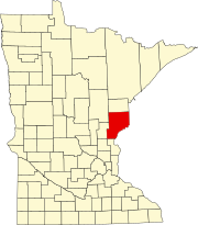
Beroun, Minnesota
Beroun, Minnesota | |
|---|---|
Unincorporated community | |
 Beroun, Minnesota Location of the community of Beroun within Mission Creek Township, Pine County Show map of Minnesota  Beroun, Minnesota Beroun, Minnesota (the United States) Show map of the United States | |
| Coordinates: 45°54′37″N 92°57′19″W / 45.91028°N 92.95528°W / 45.91028; -92.95528Coordinates: 45°54′37″N 92°57′19″W / 45.91028°N 92.95528°W / 45.91028; -92.95528 | |
| Country | United States |
| State | Minnesota |
| County | Pine |
| Township | Mission Creek Township |
| Elevation | 974 ft (297 m) |
| Population | |
| • Total | 120 |
| Time zone | UTC-6 (Central (CST)) |
| • Summer (DST) | UTC-5 (CDT) |
| ZIP code | 55063 |
| Area code(s) | 320 |
GNIS feature ID | 639974[1] |
Beroun is an unincorporated community in Mission Creek Township, Pine County, Minnesota, United States.
Interstate 35 and Pine County Roads 14 and 61 are three of the main routes in the community. Interstate 35 runs north–south, and County Road 14 (Beroun Crossing Road) runs east–west.
Beroun is located between Hinckley and Pine City.
A post office called Beroun was established in 1895, and remained in operation until 1993.[2] The community was founded by Czech immigrants, who named it after the town of Beroun in the Czech Republic. Beroun was a station on the Northern Pacific Railroad.[3]
ZIP codes 55063 (Pine City), 55037 (Hinckley), and 55007 (Brook Park) all meet near Beroun.
References
^ "Beroun, Minnesota". Geographic Names Information System. United States Geological Survey..mw-parser-output cite.citation{font-style:inherit}.mw-parser-output .citation q{quotes:"""""""'""'"}.mw-parser-output .citation .cs1-lock-free a{background:url("//upload.wikimedia.org/wikipedia/commons/thumb/6/65/Lock-green.svg/9px-Lock-green.svg.png")no-repeat;background-position:right .1em center}.mw-parser-output .citation .cs1-lock-limited a,.mw-parser-output .citation .cs1-lock-registration a{background:url("//upload.wikimedia.org/wikipedia/commons/thumb/d/d6/Lock-gray-alt-2.svg/9px-Lock-gray-alt-2.svg.png")no-repeat;background-position:right .1em center}.mw-parser-output .citation .cs1-lock-subscription a{background:url("//upload.wikimedia.org/wikipedia/commons/thumb/a/aa/Lock-red-alt-2.svg/9px-Lock-red-alt-2.svg.png")no-repeat;background-position:right .1em center}.mw-parser-output .cs1-subscription,.mw-parser-output .cs1-registration{color:#555}.mw-parser-output .cs1-subscription span,.mw-parser-output .cs1-registration span{border-bottom:1px dotted;cursor:help}.mw-parser-output .cs1-ws-icon a{background:url("//upload.wikimedia.org/wikipedia/commons/thumb/4/4c/Wikisource-logo.svg/12px-Wikisource-logo.svg.png")no-repeat;background-position:right .1em center}.mw-parser-output code.cs1-code{color:inherit;background:inherit;border:inherit;padding:inherit}.mw-parser-output .cs1-hidden-error{display:none;font-size:100%}.mw-parser-output .cs1-visible-error{font-size:100%}.mw-parser-output .cs1-maint{display:none;color:#33aa33;margin-left:0.3em}.mw-parser-output .cs1-subscription,.mw-parser-output .cs1-registration,.mw-parser-output .cs1-format{font-size:95%}.mw-parser-output .cs1-kern-left,.mw-parser-output .cs1-kern-wl-left{padding-left:0.2em}.mw-parser-output .cs1-kern-right,.mw-parser-output .cs1-kern-wl-right{padding-right:0.2em}
^ "Pine County". Jim Forte Postal History. Retrieved 30 July 2015.
^ Upham, Warren (1920). Minnesota Geographic Names: Their Origin and Historic Significance. Minnesota Historical Society. p. 411.
- Rand McNally Road Atlas – 2007 edition – Minnesota entry
- Official State of Minnesota Highway Map – 2011/2012 edition
This article about a location in Pine County, Minnesota is a stub. You can help Wikipedia by expanding it. |
