Varanasi district
Varanasi district
Jump to navigation
Jump to search
Varanasi district | |
|---|---|
District of Uttar Pradesh | |
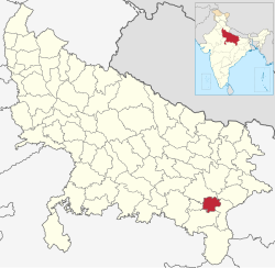 Location of Varanasi district in Uttar Pradesh | |
| Country | India |
| State | Uttar Pradesh |
| Administrative division | Varanasi |
| Headquarters | Varanasi |
| Government | |
| • Lok Sabha constituencies | Varanasi |
| Area | |
| • Total | 1,535 km2 (593 sq mi) |
| Population (2011) | |
| • Total | 3,676,841[1] |
| Website | Official website |
Varanasi is a district in the north Indian state of Uttar Pradesh with Varanasi city as the district headquarters.It is also called as kashi, according to Hindu mythology it is one of the sacred places pilgrimage for Hindus as well as Buddhists. It is believed that Lord Shiva along with Parvathi as Vishwanatha and Vishalaakshi reside there to bless devotees. It is surrounded by Mirzapur district, Jaunpur district, Ghazipur district and Chandauli district. The Ganga (Ganges) river flows through the district. It is considered by Hindus to be a sacred and pure river, having the ability to wash away sins when people take a dip in it. Part of the Varanasi division, the district occupies an area of 1,535 square kilometres (593 sq mi) and as of the 2011[update] Census of India had a population of 3,682,194.
Contents
1 Divisions
2 Demographics
2.1 Languages
3 Education
3.1 Colleges
3.2 Univeristies
4 Geography
5 References
6 External links
Divisions[edit]

Munshi Ghat, one of the ghats in the city of Varanasi
The district is made up of Five tehsils: Varanasi, Pindra, and Rajatalab[2], and eight Vidhan Sabha (Legislative Assembly) constituencies: Pindra, Ajagara, Shivpur, Rohaniya, Varanasi North, Varanasi South, Varanasi Cantt. and Sevapuri.
(Assembly constituency)|Ramnagar]]
(Assembly constituency)|Kapseti]]
Demographics[edit]
According to the 2011 census Varanasi district has a population of 3,682,194,[1] roughly equal to the nation of Liberia[3] or the US state of Oklahoma.[4] This gives it a ranking of 75th in India (out of a total of 640).[1] The district has a population density of 2,399 inhabitants per square kilometre (6,210/sq mi) .[1] Its population growth rate over the decade 2001-2011 was 17.32%.[1] Varanasi has a sex ratio of 909 females for every 1000 males,[1] and a literacy rate of 77.05%.[1]
Languages[edit]
Bhojpuri and Hindi are spoken in Varanasi and written in Devanagari scripts.
Urdu is written in the Nastaliq style of the Persian alphabet.
Sanskrit is the oldest language here. It is also taught in Varanasi.
Education[edit]
Colleges[edit]
DAV Post Graduate College Varanasi[5]
Shri Harishchandra pg college
Univeristies[edit]
Banaras Hindu University[6]
- Mahatma Gandhi Kashi Vidyapeeth University
Geography[edit]
Places adjacent to Varanasi district | ||||||||||
|---|---|---|---|---|---|---|---|---|---|---|
| ||||||||||
References[edit]
^ abcdefg "Official Census". Retrieved 2014-03-10..mw-parser-output cite.citation{font-style:inherit}.mw-parser-output .citation q{quotes:"""""""'""'"}.mw-parser-output .citation .cs1-lock-free a{background:url("//upload.wikimedia.org/wikipedia/commons/thumb/6/65/Lock-green.svg/9px-Lock-green.svg.png")no-repeat;background-position:right .1em center}.mw-parser-output .citation .cs1-lock-limited a,.mw-parser-output .citation .cs1-lock-registration a{background:url("//upload.wikimedia.org/wikipedia/commons/thumb/d/d6/Lock-gray-alt-2.svg/9px-Lock-gray-alt-2.svg.png")no-repeat;background-position:right .1em center}.mw-parser-output .citation .cs1-lock-subscription a{background:url("//upload.wikimedia.org/wikipedia/commons/thumb/a/aa/Lock-red-alt-2.svg/9px-Lock-red-alt-2.svg.png")no-repeat;background-position:right .1em center}.mw-parser-output .cs1-subscription,.mw-parser-output .cs1-registration{color:#555}.mw-parser-output .cs1-subscription span,.mw-parser-output .cs1-registration span{border-bottom:1px dotted;cursor:help}.mw-parser-output .cs1-ws-icon a{background:url("//upload.wikimedia.org/wikipedia/commons/thumb/4/4c/Wikisource-logo.svg/12px-Wikisource-logo.svg.png")no-repeat;background-position:right .1em center}.mw-parser-output code.cs1-code{color:inherit;background:inherit;border:inherit;padding:inherit}.mw-parser-output .cs1-hidden-error{display:none;font-size:100%}.mw-parser-output .cs1-visible-error{font-size:100%}.mw-parser-output .cs1-maint{display:none;color:#33aa33;margin-left:0.3em}.mw-parser-output .cs1-subscription,.mw-parser-output .cs1-registration,.mw-parser-output .cs1-format{font-size:95%}.mw-parser-output .cs1-kern-left,.mw-parser-output .cs1-kern-wl-left{padding-left:0.2em}.mw-parser-output .cs1-kern-right,.mw-parser-output .cs1-kern-wl-right{padding-right:0.2em}
^ "Rajatalab tehsil inaugurated". The Times of India. The Times of India. Retrieved 23 July 2017.
^ US Directorate of Intelligence. "Country Comparison:Population". Retrieved 2011-10-01.Liberia 3,786,764 July 2011 est.
^ "2010 Resident Population Data". U. S. Census Bureau. Retrieved 2011-09-30.Oklahoma 3,751,351
^ http://www.davpgcvns.ac.in/
^ http://www.bhu.ac.in/
External links[edit]
- Official website
Varanasi | |||||||||||||||||||||||||
|---|---|---|---|---|---|---|---|---|---|---|---|---|---|---|---|---|---|---|---|---|---|---|---|---|---|
| History |
| ||||||||||||||||||||||||
| Administrative division |
| ||||||||||||||||||||||||
Languages & Dialects spoken |
| ||||||||||||||||||||||||
| Political representation |
| ||||||||||||||||||||||||
| Constituency |
| ||||||||||||||||||||||||
| Transportation |
| ||||||||||||||||||||||||
| Education |
| ||||||||||||||||||||||||
| Places of worship |
| ||||||||||||||||||||||||
| Ghats |
| ||||||||||||||||||||||||
| Point of interest |
| ||||||||||||||||||||||||
| Hospitals |
| ||||||||||||||||||||||||

Coordinates: 25°20′N 83°00′E / 25.333°N 83.000°E / 25.333; 83.000
This Varanasi district location article is a stub. You can help Wikipedia by expanding it. |
Categories:
- Districts of Uttar Pradesh
- Varanasi district
- Districts of India
- Varanasi division geography stubs
(window.RLQ=window.RLQ||).push(function(){mw.config.set({"wgPageParseReport":{"limitreport":{"cputime":"0.576","walltime":"0.772","ppvisitednodes":{"value":4372,"limit":1000000},"ppgeneratednodes":{"value":0,"limit":1500000},"postexpandincludesize":{"value":205406,"limit":2097152},"templateargumentsize":{"value":4617,"limit":2097152},"expansiondepth":{"value":24,"limit":40},"expensivefunctioncount":{"value":5,"limit":500},"unstrip-depth":{"value":1,"limit":20},"unstrip-size":{"value":13218,"limit":5000000},"entityaccesscount":{"value":1,"limit":400},"timingprofile":["100.00% 589.740 1 -total"," 39.04% 230.259 1 Template:India_Districts"," 37.72% 222.464 1 Template:Infobox_settlement"," 22.68% 133.777 1 Template:Infobox"," 17.31% 102.063 1 Template:Reflist"," 15.59% 91.933 17 Template:Navbox"," 15.35% 90.539 4 Template:Cite_web"," 7.13% 42.047 1 Template:Use_dmy_dates"," 6.88% 40.552 1 Template:Varanasi"," 6.18% 36.435 1 Template:Official_website"]},"scribunto":{"limitreport-timeusage":{"value":"0.220","limit":"10.000"},"limitreport-memusage":{"value":7420047,"limit":52428800}},"cachereport":{"origin":"mw1276","timestamp":"20190319003231","ttl":2592000,"transientcontent":false}}});});{"@context":"https://schema.org","@type":"Article","name":"Varanasi district","url":"https://en.wikipedia.org/wiki/Varanasi_district","sameAs":"http://www.wikidata.org/entity/Q1321140","mainEntity":"http://www.wikidata.org/entity/Q1321140","author":{"@type":"Organization","name":"Contributors to Wikimedia projects"},"publisher":{"@type":"Organization","name":"Wikimedia Foundation, Inc.","logo":{"@type":"ImageObject","url":"https://www.wikimedia.org/static/images/wmf-hor-googpub.png"}},"datePublished":"2005-09-29T09:31:45Z","dateModified":"2019-03-19T00:32:34Z","image":"https://upload.wikimedia.org/wikipedia/commons/c/c8/India_Uttar_Pradesh_districts_2012_Varanasi.svg","headline":"district of Uttar Pradesh, India"}(window.RLQ=window.RLQ||).push(function(){mw.config.set({"wgBackendResponseTime":120,"wgHostname":"mw1322"});});


