Jhansi district
Jhansi district
Jump to navigation
Jump to search
Jhansi district | |
|---|---|
District of Uttar Pradesh | |
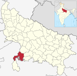 Location of Jhansi district in Uttar Pradesh | |
| Country | India |
| State | Uttar Pradesh |
| Administrative division | Jhansi |
| Headquarters | Jhansi |
| Tehsils | 1. Jhansi, 2. Mauranipur, 3. Moth, 4.Tehroli, 5.Garautha |
| Government | |
| • Lok Sabha constituencies | Jhansi |
| Area | |
| • Total | 5,024 km2 (1,940 sq mi) |
| Population (2011) | |
| • Total | 1,998,603 |
| • Density | 400/km2 (1,000/sq mi) |
| • Urban | 549,391 |
| Demographics | |
| • Sex ratio | 890 |
| Website | Official website |
Jhansi district is one of the districts of Uttar Pradesh state in northern India. The city of Jhansi is the district headquarters. The district is bordered on the north by Jalaun District, to the east by Hamirpur and Mahoba districts, to the south by Tikamgarh District of Madhya Pradesh state, to the southwest by Lalitpur District, which is joined to Jhansi District by a narrow corridor, and on the east by the Datia and Bhind districts of Madhya Pradesh. Population 19,98,603 (2011 census). Lalitpur District, which extends into the hill country to the south, was added to Jhansi District in 1891, and made a separate district again in 1974.

Jhansi Junction railway station
Contents
1 History
2 Geography
3 Demographics
4 District at a Glance
4.1 Tehsil
4.2 Development Blocks
4.3 Constituencies
5 References
6 External links
History[edit]
In 1861 the city of Jhansi and a dependent territory was ceded to Gwalior State and the capital of the district was moved to Jhansi Naoabad (Jhansi Refounded), a village without "cantonment" (military camp). Jhansi (the old city) became the capital of a "subah" (provínce) within the state of Gwalior, but in 1886 was returned to British rule as a district of the United Provinces of Agra and Oudh in exchange for the Gwalior Fort and the cantonment of Morar nearby.[1] (It had been given to the Maharaja of Gwalior, but came under British rule in 1886 as the result of a territorial swap.) The population of Jhansi in 1901 was about 55,000 while Jhansi district's population had been about 407,000 in 1891.[1]
Geography[edit]

Todi Fatehpur
Several railway lines serve the district. South of Jhansi District lies the hill country of Bundelkhand, which slopes down from the Vindhya Range. The district consists of the level plain of Bundelkhand, distinguished for its deep black soil, known as mar, and admirably adapted for the cultivation of cotton. The district is intersected or bounded by three principal rivers, the Pahuj, Betwa and Dhasan.
The main city in Jhansi district is Jhansi. Other towns are Mauranipur, Garautha, Moth, Babina, Chirgaon, Samthar Gursarai Erich, etc.
Demographics[edit]
According to the 2011 census Jhansi district has a population of 1,998,603,[2] roughly equal to the nation of Slovenia[3] or the US state of New Mexico.[4] This gives it a ranking of 231st in India (out of a total of 640).[2] The district has a population density of 398 inhabitants per square kilometre (1,030/sq mi) .[2] Its population growth rate over the decade 2001-2011 was 14.54%.[2] Jhansi has a sex ratio of 890 females for every 1000 males,[2] and a literacy rate of 69.68%.[2]
District at a Glance[edit]
Tehsil[edit]
There are 5 tehsil in district Jhansi.[5]
- Jhansi
- Mauranipur
- Garautha
- Tehroli
- Moth
Development Blocks[edit]
There are 8 Development Blocks.[6]
- Babina
- Badagaon
- Bamaur
- Bangra
- Chirgaon
- Gursarai
- Mauranipur
- Moth
Constituencies[edit]
There are 4 constituencies in Jhansi District.[7]
222 – Babina
223 - Jhansi Nagar
224 – Mauranipur
225 – Garautha
References[edit]
^ ab "Dschansi". Meyers Grosses Konversations-Lexikon. September 1905. Retrieved 18 November 2012..mw-parser-output cite.citation{font-style:inherit}.mw-parser-output .citation q{quotes:"""""""'""'"}.mw-parser-output .citation .cs1-lock-free a{background:url("//upload.wikimedia.org/wikipedia/commons/thumb/6/65/Lock-green.svg/9px-Lock-green.svg.png")no-repeat;background-position:right .1em center}.mw-parser-output .citation .cs1-lock-limited a,.mw-parser-output .citation .cs1-lock-registration a{background:url("//upload.wikimedia.org/wikipedia/commons/thumb/d/d6/Lock-gray-alt-2.svg/9px-Lock-gray-alt-2.svg.png")no-repeat;background-position:right .1em center}.mw-parser-output .citation .cs1-lock-subscription a{background:url("//upload.wikimedia.org/wikipedia/commons/thumb/a/aa/Lock-red-alt-2.svg/9px-Lock-red-alt-2.svg.png")no-repeat;background-position:right .1em center}.mw-parser-output .cs1-subscription,.mw-parser-output .cs1-registration{color:#555}.mw-parser-output .cs1-subscription span,.mw-parser-output .cs1-registration span{border-bottom:1px dotted;cursor:help}.mw-parser-output .cs1-ws-icon a{background:url("//upload.wikimedia.org/wikipedia/commons/thumb/4/4c/Wikisource-logo.svg/12px-Wikisource-logo.svg.png")no-repeat;background-position:right .1em center}.mw-parser-output code.cs1-code{color:inherit;background:inherit;border:inherit;padding:inherit}.mw-parser-output .cs1-hidden-error{display:none;font-size:100%}.mw-parser-output .cs1-visible-error{font-size:100%}.mw-parser-output .cs1-maint{display:none;color:#33aa33;margin-left:0.3em}.mw-parser-output .cs1-subscription,.mw-parser-output .cs1-registration,.mw-parser-output .cs1-format{font-size:95%}.mw-parser-output .cs1-kern-left,.mw-parser-output .cs1-kern-wl-left{padding-left:0.2em}.mw-parser-output .cs1-kern-right,.mw-parser-output .cs1-kern-wl-right{padding-right:0.2em}
^ abcdef "District Census 2011". Census2011.co.in. 2011. Retrieved 2011-09-30.
^ US Directorate of Intelligence. "Country Comparison:Population". Retrieved 2011-10-01.Slovenia 2,000,092 July 2011 est.
^ "2010 Resident Population Data". U. S. Census Bureau. Archived from the original on 2013-10-19. Retrieved 2011-09-30.New Mexico - 2,059,179
^ Jhansi
^ Jhansi
^ Jhansi
External links[edit]
- Official website
Places adjacent to Jhansi district | ||||||||||
|---|---|---|---|---|---|---|---|---|---|---|
| ||||||||||
Coordinates: 25°30′N 78°30′E / 25.500°N 78.500°E / 25.500; 78.500
Categories:
- Districts of Uttar Pradesh
- Jhansi district
- Districts of India
(window.RLQ=window.RLQ||).push(function(){mw.config.set({"wgPageParseReport":{"limitreport":{"cputime":"0.620","walltime":"0.814","ppvisitednodes":{"value":4041,"limit":1000000},"ppgeneratednodes":{"value":0,"limit":1500000},"postexpandincludesize":{"value":89281,"limit":2097152},"templateargumentsize":{"value":4454,"limit":2097152},"expansiondepth":{"value":26,"limit":40},"expensivefunctioncount":{"value":2,"limit":500},"unstrip-depth":{"value":1,"limit":20},"unstrip-size":{"value":13666,"limit":5000000},"entityaccesscount":{"value":1,"limit":400},"timingprofile":["100.00% 630.575 1 -total"," 46.04% 290.342 1 Template:India_Districts"," 44.88% 283.020 1 Template:Infobox_settlement"," 27.49% 173.358 1 Template:Infobox"," 18.31% 115.436 1 Template:Reflist"," 15.22% 95.999 4 Template:Cite_web"," 8.27% 52.152 1 Template:About"," 7.80% 49.174 1 Template:Official_website"," 7.01% 44.197 1 Template:Infobox_settlement/areadisp"," 5.97% 37.661 1 Template:Convert"]},"scribunto":{"limitreport-timeusage":{"value":"0.226","limit":"10.000"},"limitreport-memusage":{"value":5933646,"limit":52428800}},"cachereport":{"origin":"mw1242","timestamp":"20190318225744","ttl":2592000,"transientcontent":false}}});});{"@context":"https://schema.org","@type":"Article","name":"Jhansi district","url":"https://en.wikipedia.org/wiki/Jhansi_district","sameAs":"http://www.wikidata.org/entity/Q1937885","mainEntity":"http://www.wikidata.org/entity/Q1937885","author":{"@type":"Organization","name":"Contributors to Wikimedia projects"},"publisher":{"@type":"Organization","name":"Wikimedia Foundation, Inc.","logo":{"@type":"ImageObject","url":"https://www.wikimedia.org/static/images/wmf-hor-googpub.png"}},"datePublished":"2005-12-05T03:13:41Z","dateModified":"2019-01-10T08:56:47Z","image":"https://upload.wikimedia.org/wikipedia/commons/5/52/India_Uttar_Pradesh_districts_2012_Jhansi.svg","headline":"district of Uttar Pradesh, India"}(window.RLQ=window.RLQ||).push(function(){mw.config.set({"wgBackendResponseTime":107,"wgHostname":"mw1322"});});


