Shahjahanpur district
Shahjahanpur district
Jump to navigation
Jump to search
Shahjahanpur district | |
|---|---|
District of Uttar Pradesh | |
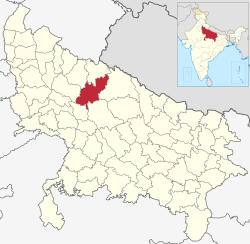 Location of Shahjahanpur district in Uttar Pradesh | |
| Country | India |
| State | Uttar Pradesh |
| Administrative division | Bareilly |
| Headquarters | Shahjahanpur |
| Tehsils | Sadar,Powayan,Tilhar,Kalan and Jalalabad |
| Government | |
| • Lok Sabha constituencies | Shahjahanpur (Lok Sabha constituency) |
| • Assembly seats | 1.Katra 2. Jalalabad 3. Tilhar 4. Powayan 5. Shahjahanpur 6. Dadraul |
| Area | |
| • Total | 4,575 km2 (1,766 sq mi) |
| Population (2011) | |
| • Total | 3,002,376 |
| • Density | 660/km2 (1,700/sq mi) |
| Demographics | |
| • Literacy | 61.61% (Male) 70.09% (Female) |
| Website | Official website |
Shahjahanpur district is one of the historical districts of Uttar Pradesh in the republic of India. It is a part of Bareilly division which is situated in south-east of Rohilkhand division. It was established in 1813 by the British Government. Previously it was a part of district Bareilly. Geographically the main town is Shahjahanpur city which is its headquarters. Its Tehsils are: Powayan, Tilhar, Jalalabad,Kalan, and Sadar.
Contents
1 History
1.1 District headquarters
2 Geography
3 Demographics
4 Notable people
5 References
6 External links
History[edit]
Shahjahanpur was established by Diler Khan and Bahadur Khan,[1] sons of Dariya Khan, a soldier in the army of Mugal Emperor Jahangir. Both Diler Khan and Bahadur Khan were dignitaries in the regime of Shahjahan. Pleased with the services of Diler Khan, Shahjahan gave him 14 villages with the permission to construct fort. Diler Khan developed a fort at Nainar Khera, situated on the joint confluence of two different rivers Garrah and Khannaut.
District headquarters[edit]
The district headquarters is still known as Shahjahanpur, which is called Shahjahanpur shahr. It has a separate municipality.
Geography[edit]
Located in the south-east of Bareilly Division, Shahjahanpur is an agriculture-based district of Uttar Pradesh. As per government notification it was established in the year 1813. Before its creation it was a part of Bareilly district. Geographically, it is situated at 27.35 N latitude and 79.37 E longitude. Adjoining districts of Shahjahanpur are Lakhimpur Kheri, Hardoi, Farrukhabad, Bareilly, Badaun, and Pilibhit. Its geographical area is 4575 metres 2.
The Ramganga, the Garrah and the Gomti are the main rivers of the district. The Kathana, the Jhukma the Mensi Rivers flow into the Gomti. The Khannaut, the Suketa and the Kai Rivers feed the Garrah.
Demographics[edit]
According to the 2011 census Shahjahanpur district has a population of 3,002,376,[2] roughly equal to the nation of Albania[3] or the US state of Mississippi.[4] This gives it a ranking of 123rd in India (out of a total of 640).[2] The district has a population density of 673 inhabitants per square kilometre (1,740/sq mi).[2] Its population growth rate over the decade 2001-2011 was 17.84%.[2] Shahjahanpur has a sex ratio of 865 females for every 1000 males[2] and a literacy rate of 61.61%.[2]
Notable people[edit]
Ram Prasad Bismil (Freedom Fighter)
Ashfaqulla Khan (Freedom Fighter)
Thakur Roshan Singh (Freedom Fighter)
Prem Krishna Khanna (Freedom Fighter)
Krant M. L. Verma (Poet, Writer & Historian).[5]
Rajpal Yadav (Bollywood Actor)
Jitin Prasada (Indian Politician, son of Jitendra Prasad)
References[edit]
^ Dr. Mehrotra N.C. Shahjahanpur Etihasik Evam Sanskritik Dharohar 1999 Pratiman Prakashan 30 Kucha Ray Ganga Prasad Allahabad 211003 India page 114
^ abcdef "District Census 2011". Census2011.co.in. 2011. Retrieved 2011-09-30..mw-parser-output cite.citation{font-style:inherit}.mw-parser-output .citation q{quotes:"""""""'""'"}.mw-parser-output .citation .cs1-lock-free a{background:url("//upload.wikimedia.org/wikipedia/commons/thumb/6/65/Lock-green.svg/9px-Lock-green.svg.png")no-repeat;background-position:right .1em center}.mw-parser-output .citation .cs1-lock-limited a,.mw-parser-output .citation .cs1-lock-registration a{background:url("//upload.wikimedia.org/wikipedia/commons/thumb/d/d6/Lock-gray-alt-2.svg/9px-Lock-gray-alt-2.svg.png")no-repeat;background-position:right .1em center}.mw-parser-output .citation .cs1-lock-subscription a{background:url("//upload.wikimedia.org/wikipedia/commons/thumb/a/aa/Lock-red-alt-2.svg/9px-Lock-red-alt-2.svg.png")no-repeat;background-position:right .1em center}.mw-parser-output .cs1-subscription,.mw-parser-output .cs1-registration{color:#555}.mw-parser-output .cs1-subscription span,.mw-parser-output .cs1-registration span{border-bottom:1px dotted;cursor:help}.mw-parser-output .cs1-ws-icon a{background:url("//upload.wikimedia.org/wikipedia/commons/thumb/4/4c/Wikisource-logo.svg/12px-Wikisource-logo.svg.png")no-repeat;background-position:right .1em center}.mw-parser-output code.cs1-code{color:inherit;background:inherit;border:inherit;padding:inherit}.mw-parser-output .cs1-hidden-error{display:none;font-size:100%}.mw-parser-output .cs1-visible-error{font-size:100%}.mw-parser-output .cs1-maint{display:none;color:#33aa33;margin-left:0.3em}.mw-parser-output .cs1-subscription,.mw-parser-output .cs1-registration,.mw-parser-output .cs1-format{font-size:95%}.mw-parser-output .cs1-kern-left,.mw-parser-output .cs1-kern-wl-left{padding-left:0.2em}.mw-parser-output .cs1-kern-right,.mw-parser-output .cs1-kern-wl-right{padding-right:0.2em}
^ US Directorate of Intelligence. "Country Comparison:Population". Retrieved 2011-10-01.Albania 2,994,667 July 2011 est.
^ "2010 Resident Population Data". U.S.Census Bureau. Retrieved 2011-09-30.Mississippi 2,967,297
^ "Dr Krant gets fellowship". The Tribune. India. Retrieved 8 Jan 2014.
External links[edit]
- Official website
- Website of Shahjahanpur
Places adjacent to Shahjahanpur district | ||||||||||
|---|---|---|---|---|---|---|---|---|---|---|
| ||||||||||
Coordinates: 28°00′N 79°50′E / 28.000°N 79.833°E / 28.000; 79.833
Categories:
- Districts of Uttar Pradesh
- Shahjahanpur district
- 1813 establishments in India
(window.RLQ=window.RLQ||).push(function(){mw.config.set({"wgPageParseReport":{"limitreport":{"cputime":"0.528","walltime":"0.673","ppvisitednodes":{"value":3836,"limit":1000000},"ppgeneratednodes":{"value":0,"limit":1500000},"postexpandincludesize":{"value":88667,"limit":2097152},"templateargumentsize":{"value":4827,"limit":2097152},"expansiondepth":{"value":26,"limit":40},"expensivefunctioncount":{"value":2,"limit":500},"unstrip-depth":{"value":1,"limit":20},"unstrip-size":{"value":12723,"limit":5000000},"entityaccesscount":{"value":1,"limit":400},"timingprofile":["100.00% 547.270 1 -total"," 46.67% 255.395 1 Template:India_Districts"," 45.35% 248.167 1 Template:Infobox_settlement"," 29.66% 162.340 1 Template:Infobox"," 20.94% 114.615 1 Template:Reflist"," 18.92% 103.561 4 Template:Cite_web"," 9.42% 51.530 1 Template:About"," 6.70% 36.655 1 Template:Convert"," 6.37% 34.878 1 Template:Official_website"," 5.95% 32.572 1 Template:Infobox_settlement/areadisp"]},"scribunto":{"limitreport-timeusage":{"value":"0.213","limit":"10.000"},"limitreport-memusage":{"value":5929763,"limit":52428800}},"cachereport":{"origin":"mw1269","timestamp":"20190319032049","ttl":2592000,"transientcontent":false}}});});{"@context":"https://schema.org","@type":"Article","name":"Shahjahanpur district","url":"https://en.wikipedia.org/wiki/Shahjahanpur_district","sameAs":"http://www.wikidata.org/entity/Q1812557","mainEntity":"http://www.wikidata.org/entity/Q1812557","author":{"@type":"Organization","name":"Contributors to Wikimedia projects"},"publisher":{"@type":"Organization","name":"Wikimedia Foundation, Inc.","logo":{"@type":"ImageObject","url":"https://www.wikimedia.org/static/images/wmf-hor-googpub.png"}},"datePublished":"2005-09-24T14:38:17Z","dateModified":"2019-02-19T18:32:29Z","image":"https://upload.wikimedia.org/wikipedia/commons/a/aa/India_Uttar_Pradesh_districts_2012_Shahjahanpur.svg","headline":"district of Uttar Pradesh, India"}(window.RLQ=window.RLQ||).push(function(){mw.config.set({"wgBackendResponseTime":117,"wgHostname":"mw1333"});});


