Australian National Heritage List
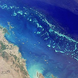 Satellite image of part of the Great Barrier Reef adjacent to the Queensland coastal areas of Airlie Beach and Mackay. | |
| Type | Heritage register of natural, historic and indigenous places that are not owned by the Commonwealth of Australia |
|---|---|
| Country | Australia |
| Years | 2012–present |
| Preceded by | Register of the National Estate |
| Compiled by | Commonwealth of Australia via the Australian Heritage Council |
| Approved by | Minister for the Environment |
The Australian National Heritage List is a heritage register, a list of national heritage places deemed to be of outstanding heritage significance to Australia. The list includes natural, historic and indigenous places. Once on the National Heritage List the provisions of the Environment Protection and Biodiversity Conservation Act 1999 apply.[1]
The Australian National Heritage List, together with the Commonwealth Heritage List, replaced the former Register of the National Estate. Places on the Australian National Heritage List are places of outstanding heritage value for Australia and the Commonwealth Heritage List for heritage places that are owned or controlled by the Commonwealth of Australia.[2][3]
Contents
1 Criteria for listing
2 Composition
3 List
4 Notes
5 Further notes about table
6 See also
7 References
8 External links
Criteria for listing
To be included on the list, a nominated place is assessed by the Australian Heritage Council against nine criteria:[4]
- importance in the course, or pattern, of Australia's natural or cultural history
- possession of uncommon, rare or endangered aspects of Australia's natural or cultural history
- potential to yield information that will contribute to an understanding of Australia's natural or cultural history
- importance in demonstrating the principal characteristics of a class of Australia's natural or cultural places or environments
- importance in exhibiting particular aesthetic characteristics valued by a community or cultural group
- importance in demonstrating a high degree of creative or technical achievement at a particular period
- strong or special association with a particular community or cultural group for social, cultural or spiritual reasons
- special association with the life or works of a person, or group of persons, of importance in Australia's natural or cultural history
- importance as part of Indigenous tradition.
In addition, the place must pass a "significance threshold"; it must have 'outstanding' heritage value to the nation as a whole. This is determined by comparison to other similar places. Once the Heritage Council has made an assessment, it forwards a recommendation to the Minister for the Environment, who shall make a determination.[4]
Composition
As of 28 September 2017[update], the Australian National Heritage List comprised 119 heritage places as follows:[5]
| State/territory | Number of places |
|---|---|
| Australian Capital Territory | 5 |
| New South Wales | 35 |
| Northern Territory | 4 |
| Queensland | 13 |
| South Australia | 8 |
| Tasmania | 11 |
| Victoria | 32 |
| Western Australia | 15 |
| Other territories | 3 |
| (duplicates): | (4)[a] |
| Total: | 119 |
List
The Australian National Heritage List comprises the following sites:
| # | Image | Listed place | State | Date listed | Coordinates | Notes |
|---|---|---|---|---|---|---|
| 1 | 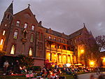 | Abbotsford Convent (listing) | Victoria | 31 August 2017 | 37°48′09″S 145°00′14″E / 37.8025°S 145.003889°E / -37.8025; 145.003889 (Abbottsford Convent) | |
| 2 | 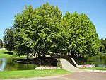 | Adelaide Park Lands and City Layout (listing) | South Australia | 7 November 2008 | 34°56′05″S 138°37′00″E / 34.93467°S 138.6167°E / -34.93467; 138.6167 (Adelaide Park Lands) | |
| 3 |  | Australian Academy of Science Building (listing) | Australian Capital Territory | 21 November 2005 | 35°17′01.2″S 149°07′21.4″E / 35.283667°S 149.122611°E / -35.283667; 149.122611 (Australian Academy of Science) | |
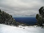
| 4 | 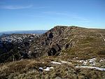 | Australian Alps National Parks and Reserves – Alpine National Park (listing) | Victoria | 7 November 2008 | 36°29′59″S 148°03′50″E / 36.49972°S 148.06389°E / -36.49972; 148.06389 (Alpine National Park) | |
| Australian Alps National Parks and Reserves – Avon Wilderness (listing) | Victoria | 37°36′45″S 146°50′34″E / 37.61250°S 146.84278°E / -37.61250; 146.84278 (Avon Wilderness Park) | ||||
 | Australian Alps National Parks and Reserves – Baw Baw National Park (listing) | Victoria | 37°45′50″S 146°13′23″E / 37.76389°S 146.22306°E / -37.76389; 146.22306 (Baw Baw National Park) | |||
 | Australian Alps National Parks and Reserves – Bimberi Nature Reserve (listing) | New South Wales | 35°34′54″S 148°45′04″E / 35.58167°S 148.75111°E / -35.58167; 148.75111 (Bimberi Nature Reserve) | |||
 | Australian Alps National Parks and Reserves – Brindabella National Park (listing) | New South Wales | 35°13′54″S 148°46′44″E / 35.23167°S 148.77889°E / -35.23167; 148.77889 (Brindabella National Park) | |||
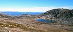 | Australian Alps National Parks and Reserves – Kosciuszko National Park (listing) | New South Wales | 36°04′20″S 148°20′55″E / 36.07222°S 148.34861°E / -36.07222; 148.34861 (Kosciuszko National Park) | |||
 | Australian Alps National Parks and Reserves – Mount Buffalo National Park (listing) | Victoria | 36°44′18″S 146°46′30″E / 36.73833°S 146.77500°E / -36.73833; 146.77500 (Mount Buffalo National Park) | |||
 | Australian Alps National Parks and Reserves – Namadgi National Park (listing) | Australian Capital Territory | 35°40′00″S 148°57′00″E / 35.66667°S 148.95000°E / -35.66667; 148.95000 (Namadgi National Park) | |||
| Australian Alps National Parks and Reserves – Scabby Range Nature Reserve (listing) | New South Wales | 35°45′55″S 148°52′04″E / 35.76528°S 148.86778°E / -35.76528; 148.86778 (Scabby Range) | ||||
 | Australian Alps National Parks and Reserves – Snowy River National Park (listing) | Victoria | 37°16′30″S 148°33′12″E / 37.27500°S 148.55333°E / -37.27500; 148.55333 (Snowy River) | |||
 | Australian Alps National Parks and Reserves – Tidbinbilla Nature Reserve (listing) | Australian Capital Territory | 35°27′47″S 148°54′38″E / 35.46306°S 148.91056°E / -35.46306; 148.91056 (Tidbinbilla Nature Reserve) | |||
| 5 | 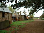 | Australian Convict Sites – Brickendon Estate (listing) | Tasmania | 23 June 2007 | 41°37′01″S 147°07′39″E / 41.61694°S 147.12750°E / -41.61694; 147.12750 (Brickendon Estate) | World Heritage Site 2010 |
 | Australian Convict Sites – Cascades Female Factory and Yard 4 North (listing) | Tasmania | 1 August 2007[B] | 42°53′37″S 147°17′57″E / 42.89361°S 147.29917°E / -42.89361; 147.29917 (Cascades Female Factory) | ||
 | Australian Convict Sites – Coal Mines Historic Site (listing) | Tasmania | 1 August 2007 | 42°59′01″S 147°42′59″E / 42.98361°S 147.71639°E / -42.98361; 147.71639 (Coal Mines) | ||
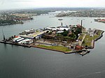 | Australian Convict Sites – Cockatoo Island (listing) | New South Wales | 1 August 2007 | 33°50′49″S 151°10′16″E / 33.84684°S 151.17115°E / -33.84684; 151.17115 (Cockatoo Island) | ||
 | Australian Convict Sites – Darlington Probation Station (listing) | Tasmania | 1 August 2007 | 42°34′54″S 148°04′12″E / 42.58167°S 148.07000°E / -42.58167; 148.07000 (Darlington Probation Station) | ||
 | Australian Convict Sites – Fremantle Prison (listing) | Western Australia | 1 August 2005 | 32°3′18″S 115°45′13″E / 32.05500°S 115.75361°E / -32.05500; 115.75361 (Fremantle Prison) | ||
 | Australian Convict Sites – Old Great North Road (listing) | New South Wales | 1 August 2007 | 33°22′42″S 150°59′40″E / 33.37833°S 150.99444°E / -33.37833; 150.99444 (Old Great North Road) | ||
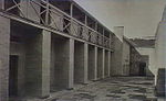
 | Australian Convict Sites – Hyde Park Barracks (listing) | New South Wales | 1 August 2007 | 33°52′10″S 151°12′45″E / 33.86944°S 151.21250°E / -33.86944; 151.21250 (Hyde Park Barracks) | ||
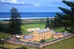 | Australian Convict Sites – Kingston and Arthurs Vale Historic Area (listing) | Norfolk Island | 1 August 2007 | 29°03′12″S 167°57′31″E / 29.05333°S 167.95861°E / -29.05333; 167.95861 (KAVHA) | ||
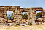
 | Australian Convict Sites – Old Government House and Government Domain (listing) | New South Wales | 1 August 2007 | 33°48′35″S 150°59′42″E / 33.80972°S 150.99500°E / -33.80972; 150.99500 (Old Government House) | ||
 | Australian Convict Sites – Port Arthur Historic site (listing) | Tasmania | 3 June 2005 | 43°08′52″S 147°51′05″E / 43.14778°S 147.85139°E / -43.14778; 147.85139 (Port Arthur) | ||
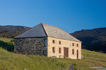
 | Australian Convict Sites – Woolmers Estate (listing) | Tasmania | 23 November 2007 | 41°37′01″S 147°07′48″E / 41.61694°S 147.13000°E / -41.61694; 147.13000 (Woolmers Estate) | ||
| 6 |  | Australian Cornish Mining Sites – Burra (listing) | South Australia | 9 May 2017 | 33°40′47″S 138°55′03″E / 33.67972°S 138.91750°E / -33.67972; 138.91750 (Australian Cornish Mining Sites – Burra) | |
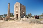 | Australian Cornish Mining Sites – Moonta (listing) | 34°04′32″S 137°36′31″E / 34.07556°S 137.60861°E / -34.07556; 137.60861 (Australian Cornish Mining Sites – Moonta) | ||||
| 7 | 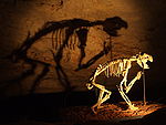 | Australian Fossil Mammal Sites (Naracoorte) (listing) | South Australia | 21 May 2007[A] | 36°57′S 140°45′E / 36.950°S 140.750°E / -36.950; 140.750 (Naracoorte Caves) | Inscribed as a World Heritage Site in 1994 |
 | Australian Fossil Mammal Sites (Riversleigh) (listing) | Queensland | 19°04′59″S 138°43′01″E / 19.083°S 138.717°E / -19.083; 138.717 (Riversleigh) | World Heritage Site 1994 | ||
| 8 | 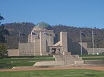 | Australian War Memorial and the Memorial Parade (listing) | Australian Capital Territory | 25 April 2006 | 35°16′49.76″S 149°08′56.56″E / 35.2804889°S 149.1490444°E / -35.2804889; 149.1490444 (Australian War Memorial) | |
| 9 | 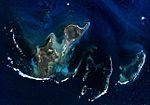 | Batavia Shipwreck Site and Survivor Camps Area 1629, Houtman Abrolhos (listing) | Western Australia | 6 April 2006 | 28°29′25″S 113°47′36″E / 28.49028°S 113.79333°E / -28.49028; 113.79333 (Batavia Shipwreck Site) | |
| 10 | 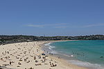 | Bondi Beach (listing) | New South Wales | 25 January 2008 | 33°53′28″S 151°16′40″E / 33.8910°S 151.2778°E / -33.8910; 151.2778 (Bondi Beach) | |
| 11 |  | Bonegilla Migrant Camp – Block 19 (listing) | Victoria | 7 December 2007 | 36°07′52″S 147°00′49″E / 36.1310°S 147.0136°E / -36.1310; 147.0136 (Bonegilla) | |
| 12 | 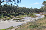 | Brewarrina Aboriginal Fish Traps (Baiames Ngunnhu) (listing) | New South Wales | 3 June 2005 | ||
| 13 | 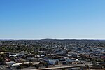 | City of Broken Hill (listing) | New South Wales | 20 January 2015 | 31°57′S 141°27′E / 31.950°S 141.450°E / -31.950; 141.450 (Broken Hill) | |
| 14 | Budj Bim National Heritage Landscape – Tyrendarra Area (listing) | Victoria | 20 July 2004 | 38°12′00″S 141°46′00″E / 38.20000°S 141.76667°E / -38.20000; 141.76667 (Budj Bim Tyrendarra) | ||
 | Budj Bim National Heritage Landscape – Mount Eccles Lake Condah Area (listing) | 38°04′00″S 141°55′00″E / 38.06667°S 141.91667°E / -38.06667; 141.91667 (Mount Eccles) | ||||
| 15 | 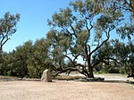 | The Burke, Wills, King and Yandruwandha National Heritage Place (listing) | Queensland, South Australia | 22 January 2016 | ||
| 16 | 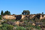 | Castlemaine Diggings National Heritage Park (listing) | Victoria | 27 January 2005 | 37°11′29″S 144°12′59″E / 37.19139°S 144.21639°E / -37.19139; 144.21639 (Castlemaine Diggings National Heritage Park) | |
| 17 | 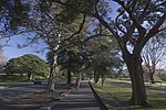 | Centennial Park (listing) | New South Wales | 3 October 2018 | 33°54′S 151°14′E / 33.900°S 151.233°E / -33.900; 151.233 (Centennial Park) | |
| 18 | Cheetup Rock Shelter (listing) | Western Australia | 23 October 2009 | |||
| 19 | 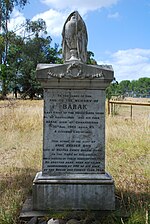 | Coranderrk (listing) | Victoria | 7 June 2011 | 37°41′02″S 145°31′19″E / 37.684007°S 145.521938°E / -37.684007; 145.521938 (Coranderrk) | |
| 20 |  | Cyprus Hellene Club - Australian Hall (listing) | New South Wales | 20 May 2008 | Site of the Aboriginal Day of Mourning in 1938 | |
| 21 | Dampier Archipelago (listing) | Western Australia | 3 July 2007 | 20°34′52″S 116°48′29″E / 20.581°S 116.808°E / -20.581; 116.808 (Dampier Archipelago) | ||
| 22 | 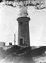 | Dirk Hartog Landing Site 1616 – Cape Inscription Area (listing) | Western Australia | 6 April 2006 | ||
| 23 | 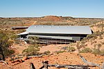 | Dinosaur Stampede National Monument (listing) | Queensland | 20 July 2004 | 23°00′58″S 142°24′41″E / 23.0161°S 142.4114°E / -23.0161; 142.4114 (Dinosaur Stampede) | |
| 24 | 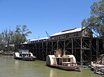 | Echuca Wharf (listing) | Victoria | 26 April 2007 | 36°07′12″S 144°44′50″E / 36.1199°S 144.7473°E / -36.1199; 144.7473 (Echuca Wharf) | |
| 25 |  | Ediacara Fossil Site – Nilpena (listing) | South Australia | 11 January 2007 | 30°48′28″S 138°08′15″E / 30.80778°S 138.13750°E / -30.80778; 138.13750 (Ediacara Fossil Site) | |
| 26 | Elizabeth Springs (listing) | Queensland | 4 August 2009 | |||
| 27 | 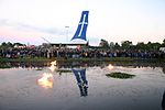 | Eureka Stockade Gardens (listing) | Victoria | 8 December 2004 | 37°33′55″S 143°53′3″E / 37.56528°S 143.88417°E / -37.56528; 143.88417 (Eureka Stockade Gardens) | |
| 28 |  | First Government House Site, Sydney (listing) | New South Wales | 19 August 2005 | ||
| 29 |  | Fitzgerald River National Park (listing) | Western Australia | 6 May 2016 | 33°56′51″S 119°36′55″E / 33.94750°S 119.61528°E / -33.94750; 119.61528 (Fitzgeral River National Park) | |
| 30 | 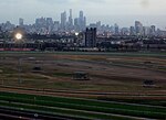 | Flemington Racecourse (listing) | Victoria | 7 November 2006 | 37°47′25″S 144°54′45″E / 37.79028°S 144.91250°E / -37.79028; 144.91250 (Flemington Racecourse) | |
| 31 | 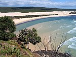 | Fraser Island (listing) | Queensland | 21 May 2007[A] | 25°13′S 153°08′E / 25.217°S 153.133°E / -25.217; 153.133 (Fraser Island) | World Heritage Site 1992 |
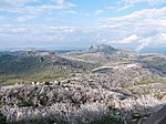
| 32 | 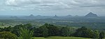 | Glass House Mountains National Landscape (listing) | Queensland | 3 August 2006 | 26°50′51″S 152°57′15″E / 26.84750°S 152.95417°E / -26.84750; 152.95417 (Glass House Mountains) | |
| 33 | 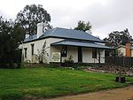 | Glenrowan Heritage Precinct (listing) | Victoria | 5 July 2005 | 36°28′S 146°14′E / 36.467°S 146.233°E / -36.467; 146.233 (Glenrowan Heritage Precinct) | Site of the Siege of Glenrowan and the capture of Ned Kelly |
| 34 | 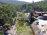 | Goldfields Water Supply Scheme (listing) | Western Australia | 23 June 2011 | ||
| 35 |  | Gondwana Rainforests – Barrington Tops Area (listing) | New South Wales | 21 May 2007[A] | 32°03′10″S 151°29′37″E / 32.05278°S 151.49361°E / -32.05278; 151.49361 (Barrington Tops) | World Heritage Site 1986 |
 | Gondwana Rainforests – Focal Peak Group (listing) | NSW, Qld | ||||
 | Gondwana Rainforests – Hastings-Macleay Group (listing) | New South Wales | ||||
 | Gondwana Rainforests – Iluka Nature Reserve (listing) | New South Wales | ||||
 | Gondwana Rainforests – Main Range National Park (listing) | NSW, Qld | 27°48′57″S 152°15′56″E / 27.81583°S 152.26556°E / -27.81583; 152.26556 (Main Range) | |||
 | Gondwana Rainforests – New England Group (listing) | New South Wales | ||||
 | Gondwana Rainforests – Shield Volcano Group (listing) | NSW, Qld | ||||
 | Gondwana Rainforests – Washpool and Gibraltar Range (listing) | New South Wales | ||||
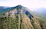
| 36 | 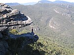 | Grampians National Park (Gariwerd) (listing) | Victoria | 15 December 2006 | 37°12′28″S 142°23′59″E / 37.20778°S 142.39972°E / -37.20778; 142.39972 (Grampians) | |
| 37 | 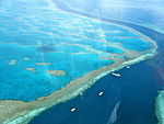 | Great Barrier Reef (listing) | Queensland | 21 May 2007[A] | 18°17′10″S 147°42′00″E / 18.28611°S 147.70000°E / -18.28611; 147.70000 (Great Barrier Reef) | World Heritage Site 1981 |
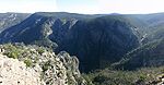
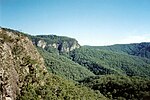
| 38 | 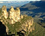 | Greater Blue Mountains Area (listing) | New South Wales | 21 May 2007[A] | 33°43′05″S 150°18′38″E / 33.71806°S 150.31056°E / -33.71806; 150.31056 (Greater Blue Mountains Area) | World Heritage Site 2000 |
| 39 | 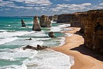 | Great Ocean Road (listing) | Victoria | 7 April 2011 | 38°44′02″S 143°41′14″E / 38.73389°S 143.68722°E / -38.73389; 143.68722 (Great Ocean Road) | |
| 40 | 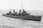 | HMAS Sydney and HSK Kormoran shipwreck sites (listing) | Western Australia | 14 March 2011 | 26°14′31″S 111°12′48″E / 26.24194°S 111.21333°E / -26.24194; 111.21333 (HMAS Sydney) | The two ships lie 22 kilometres (14 mi) apart. |
| 41 | 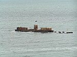 | HMVS Cerberus (listing) | Victoria | 14 December 2005 | 37°58′03″S 145°00′28″E / 37.9675°S 145.0079°E / -37.9675; 145.0079 (HMVS Cerberus) | |
| 42 | 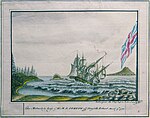 | HMS Sirius (listing) | Norfolk Island | 25 October 2011 | 29°2′36.9″S 167°57′18″E / 29.043583°S 167.95500°E / -29.043583; 167.95500 (HMS Sirius) | |
| 43 | 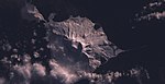 | Heard and McDonald Islands (listing) | External territory | 21 May 2007[A] | 53°06′00″S 73°31′00″E / 53.10000°S 73.51667°E / -53.10000; 73.51667 (Heard Island) | World Heritage Site 1997 |
| 44 |  | Hermannsburg Historic Precinct (listing) | Northern Territory | 13 April 2006 | 23°56′35″S 132°46′40″E / 23.942957°S 132.777915°E / -23.942957; 132.777915 (Hermannsburg) | |
| 45 | 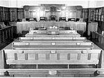 | High Court of Australia (former) (listing) | Victoria | 11 July 2007 | ||
| 46 | 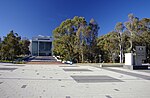 | High Court – National Gallery precinct (listing) | Australian Capital Territory | 23 November 2007 | ||
| 47 | 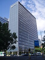 | ICI Building (listing) | Victoria | 21 September 2005 | 37°48′32″S 144°58′24″E / 37.809°S 144.97344°E / -37.809; 144.97344 (ICI building) | |
| 48 | 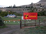 | Jordan River Levee (listing) | Tasmania | 23 December 2011 | Archeological site on a tributary of the River Derwent | |
| 49 |  | Kamay Botany Bay (listing) | New South Wales | 15 December 2006 | 34°01′14″S 151°13′29″E / 34.02056°S 151.22472°E / -34.02056; 151.22472Coordinates: 34°01′14″S 151°13′29″E / 34.02056°S 151.22472°E / -34.02056; 151.22472 | |
| 50 | 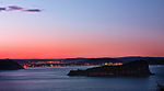 | Ku-ring-gai Chase National Park, Lion Island, Long Island and Spectacle Island Nature Reserves (listing) | New South Wales | 15 December 2006 | ||
| 51 | 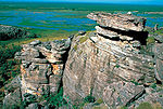 | Kakadu National Park (listing) | Northern Territory | 21 May 2007[A] | World Heritage Site 1981 | |
| 52 | 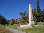 | Kurnell Peninsula Headland (listing) | New South Wales | 20 September 2004 | James Cook's first landing site in Australia in 1770 | |
| 53 | Koonalda Cave (listing) | South Australia | 15 October 2014 | 31°24′S 129°53′E / 31.400°S 129.883°E / -31.400; 129.883 (Koonalda Cave) | ||
| 54 | 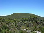 | Lesueur National Park (listing) | Western Australia | 6 May 2016 | 30°08′04″S 115°06′02″E / 30.13444°S 115.10056°E / -30.13444; 115.10056 (Lesueur National Park) | |
| 55 |  | Lord Howe Island Group (listing) | New South Wales | 21 May 2007[A] | 31°33′S 159°05′E / 31.550°S 159.083°E / -31.550; 159.083 (Lord Howe Island) | World Heritage Site 1982 |
| 56 | 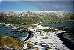 | Macquarie Island (listing) | Tasmania | 21 May 2007[A] | 54°37′00″S 158°51′00″E / 54.6167°S 158.85°E / -54.6167; 158.85 (Macquarie Island) | World Heritage Site 1997 |
| 57 | 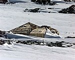 | Mawsons Huts and Mawsons Huts Historic site (listing) | Australian Antarctic Territory | 27 January 2005 | 67°00′30″S 142°39′40″E / 67.00833°S 142.66111°E / -67.00833; 142.66111 (Mawsons Huts) | |
| 58 | 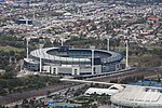 | Melbourne Cricket Ground (listing) | Victoria | 26 December 2005 | 37°49′12″S 144°59′0″E / 37.82000°S 144.98333°E / -37.82000; 144.98333 (Melbourne Cricket Ground) | |
| 59 | 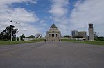 | Melbourne's Domain Parkland and Memorial Precinct (listing) | Victoria | 11 February 2018 | 37°49′14″S 144°58′08″E / 37.82056°S 144.96889°E / -37.82056; 144.96889 (Melbourne's Domain Parkland and Memorial Precinct) | "The area was previously included in the National Heritage List using the emergency listing provisions of the Environment Protection and Biodiversity Act 1999 on 13 February 2017. The area was reviewed further under these provisions leading to a decision to keep the place with some alterations to its boundary and heritage values." |
| 60 | 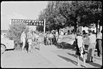 | Moree Baths and Swimming Pool Complex (listing) | New South Wales | 6 September 2013 | 29°28′27″S 149°50′48″E / 29.47417°S 149.84667°E / -29.47417; 149.84667 (Moree Baths and Swimming Pool Complex) | |
| 61 | 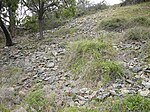 | Mount William Stone Hatchet Quarry (listing) | Victoria | 25 February 2008 | 37°12′38″S 144°48′37″E / 37.210516°S 144.810297°E / -37.210516; 144.810297 (Mount William Stone Hatchet Quarry) | |
| 62 |  | Murtoa No. 1 Grain Shed (listing) | Victoria | 1 October 2014 | 36°37′23″S 142°28′41″E / 36.6231°S 142.478°E / -36.6231; 142.478 (Murtoa No. 1 Grain Shed) | |
| 63 | Myall Creek Massacre and Memorial Site (listing) | New South Wales | 7 June 2008 | 29°46′52″S 150°42′45″E / 29.781168°S 150.712613°E / -29.781168; 150.712613 (Myall Creek Massacre and Memorial Site) | ||
| 64 | 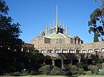 | Newman College (listing) | Victoria | 21 September 2005 | 37°47′42″S 144°57′49″E / 37.79500°S 144.96361°E / -37.79500; 144.96361 (Newman College) | |
| 65 | 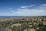 | The Ningaloo Coast (listing) | Western Australia | 6 January 2010 | ||
| 66 | 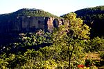 | Ngarrabullgan (listing) | Queensland | 12 May 2011 | ||
| 67 |  | North Head, Sydney (listing) | New South Wales | 12 May 2006 | ||
| 68 | 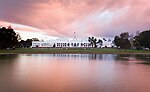 | Old Parliament House and Curtilage (listing) | Australian Capital Territory | 20 June 2006 | 35°18′08″S 149°07′48″E / 35.302097°S 149.12992°E / -35.302097; 149.12992 (Old Parliament House) | |
| 69 | 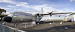 | Point Cook Air Base (listing) | Victoria | 29 August 2007 | 37°55′54″S 144°45′12″E / 37.93167°S 144.75333°E / -37.93167; 144.75333 (Point Cook Air Base) | |
| 70 | 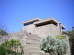 | Point Nepean Defence Sites and Quarantine Station Area (listing) | Victoria | 16 June 2006 | ||
| 71 | 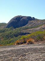 | Porongurup National Park (listing) | Western Australia | 4 August 2009 | ||
| 72 |  | Purnululu National Park (listing) | Western Australia | 21 May 2007[A] | World Heritage Site 2003 | |
| 73 | 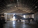 | QANTAS hangar, Longreach (listing) | Queensland | 2 May 2009 | 23°26′11″S 144°16′28″E / 23.436474°S 144.27452°E / -23.436474; 144.27452 (Qantas Hangar, Longreach) | |
| 74 |  | Queen Victoria Market (listing) | Victoria | 23 July 2018 | 37°48′25″S 144°57′24″E / 37.806966°S 144.956693°E / -37.806966; 144.956693 (Queen Victoria Market) | |
| 75 | 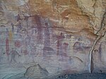 | Quinkan Country (listing) | Queensland | 10 November 2018 | 15°38′42″S 144°30′26″E / 15.64500°S 144.50722°E / -15.64500; 144.50722 (Quinkan Country) | |
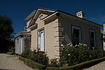
| 76 | 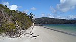 | Recherche Bay (North East Peninsula) Area (listing) | Tasmania | 7 October 2005 | ||
| 77 | Richmond Bridge (listing) | Tasmania | 25 November 2005 | |||
| 78 | 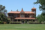 | Rippon Lea House and Gardens (listing) | Victoria | 11 August 2006 | 37°52′45″S 144°59′58″E / 37.8792°S 144.9995°E / -37.8792; 144.9995 (Rippon Lea) | |
| 79 | 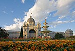 | Royal Exhibition Building and Carlton Gardens (listing) | Victoria | 20 July 2004 | 37°48′17″S 144°58′16″E / 37.804728°S 144.971225°E / -37.804728; 144.971225 (Royal Exhibition Buildings) | World Heritage Site 2004 |
| 80 | 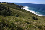 | Royal National Park and Garawarra State Conservation Area (listing) | New South Wales | 15 September 2006 | ||
| 81 |  | Shark Bay (listing) | Western Australia | 21 May 2007[A] | World Heritage Site 1991 | |
| 82 |  | Sidney Myer Music Bowl (listing) | Victoria | 21 September 2005 | 37°49′24″S 144°58′28″E / 37.82329°S 144.974454°E / -37.82329; 144.974454 (Sidney Myer Music Bowl) | |
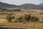
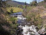
| 83 |  | Snowy Mountains Scheme (listing) | New South Wales | 14 October 2016 | 36°18′S 148°28′E / 36.300°S 148.467°E / -36.300; 148.467 (Snowy Mountains Scheme) | |
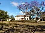
| 84 |  | South Australia's Parliament House (listing) | South Australia | 26 January 2006 | ||
| 85 | 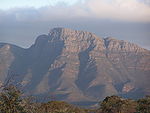 | Stirling Range National Park (listing) | Western Australia | 15 December 2006 | ||
| 86 | 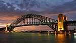 | Sydney Harbour Bridge (listing) | New South Wales | 19 March 2007 | 33°51′08″S 151°12′38″E / 33.85222°S 151.21056°E / -33.85222; 151.21056 (Sydney Harbour Bridge) | |
| 87 |  | Sydney Opera House (listing) | New South Wales | 12 July 2005 | 33°51′25″S 151°12′55″E / 33.85694°S 151.21528°E / -33.85694; 151.21528 (Sydney Opera House) | World Heritage Site 2007 |
| 88 |  | Tasmanian Wilderness (listing) | Tasmania | 21 May 2007[A] | World Heritage Site 1982 | |
| 89 | 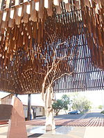 | Tree of Knowledge, Barcaldine (listing) | Queensland | 26 January 2006 | Poisoned in 2006 and felled in 2007 | |
| 90 |  | Uluru-Kata Tjuta National Park (listing) | Northern Territory | 21 May 2007[A] | 25°20′42″S 131°02′10″E / 25.34500°S 131.03611°E / -25.34500; 131.03611 (Uluru-Kata Tjuta National Park) | World Heritage Site 1987 |
| 91 | 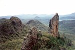 | Warrumbungle National Park (listing) | New South Wales | 15 December 2006 | 31°13′54″S 149°01′04″E / 31.23167°S 149.01778°E / -31.23167; 149.01778 (Warrumbungle National Park) | |
| 92 | Wave Hill walk-off route (listing) | Northern Territory | 9 August 2007 | |||
| 93 | 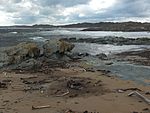 | Western Tasmania Aboriginal Cultural Landscape (listing) | Tasmania | 8 February 2013 | ||
| 94 | 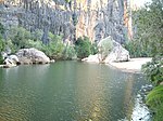 | West Kimberley (listing) | Western Australia | 31 August 2011 | ||
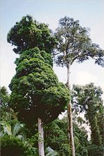
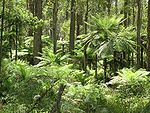
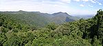
| 95 | 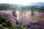 | Wet Tropics of Queensland (listing) | Queensland | 21 May 2007[A] | World Heritage Site 1988 | |
| 96 | Wilgie Mia (listing) | Western Australia | 24 February 2011 | 26°58′S 117°39′E / 26.967°S 117.650°E / -26.967; 117.650 (Wilgie Mia) | ||
| 97 | 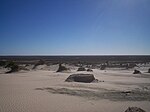 | Willandra Lakes Region (listing) | New South Wales | 21 May 2007[A] | 33°39′55″S 143°00′04″E / 33.66528°S 143.00111°E / -33.66528; 143.00111 (Willandra Lakes) | World Heritage Site 1981 Includes Lake Mungo |
| 98 | 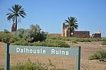 | Witjira-Dalhousie Springs (listing) | South Australia | 4 August 2009 | 26°27′39″S 135°31′23″E / 26.46083°S 135.52306°E / -26.46083; 135.52306 (Dalhousie Springs) | |
| 99 | 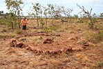 | Wurrwurrwuy stone arrangements (listing) | Northern Territory | 7 August 2013 | 12°19′52″S 136°55′58″E / 12.3311°S 136.9328°E / -12.3311; 136.9328 (Wurrwurrwuy stone arrangements) | |
| 100 | Yea Flora Fossil Site (listing) | Victoria | 11 January 2007 | 37°13′15″S 145°26′57″E / 37.22083°S 145.44917°E / -37.22083; 145.44917 (Yea Flora Fossil Site) |
Notes
A One of 15 World Heritage places included in the National Heritage List on 21 May 2007.
B Yard 4 North was added on 4 August 2009.
Further notes about table
^ The following historic resources are included within multiple state lists:
Australian Alps (ACT, NSW, Victoria)- Gondwana Rainforests – Focal Peak Group (NSW and Qld)
- Gondwana Rainforests – Main Range National Park (NSW and Qld)
- Gondwana Rainforests – Shield Volcano Group (NSW and Qld)
Australian Convict Sites (New South Wales, Tasmania, Western Australia)
See also
- Commonwealth Heritage List
References
^ "Environment Protection and Biodiversity Conservation Act 1999, Section 324A". Australasian Legal Information Institute. Retrieved 28 June 2015..mw-parser-output cite.citation{font-style:inherit}.mw-parser-output .citation q{quotes:"""""""'""'"}.mw-parser-output .citation .cs1-lock-free a{background:url("//upload.wikimedia.org/wikipedia/commons/thumb/6/65/Lock-green.svg/9px-Lock-green.svg.png")no-repeat;background-position:right .1em center}.mw-parser-output .citation .cs1-lock-limited a,.mw-parser-output .citation .cs1-lock-registration a{background:url("//upload.wikimedia.org/wikipedia/commons/thumb/d/d6/Lock-gray-alt-2.svg/9px-Lock-gray-alt-2.svg.png")no-repeat;background-position:right .1em center}.mw-parser-output .citation .cs1-lock-subscription a{background:url("//upload.wikimedia.org/wikipedia/commons/thumb/a/aa/Lock-red-alt-2.svg/9px-Lock-red-alt-2.svg.png")no-repeat;background-position:right .1em center}.mw-parser-output .cs1-subscription,.mw-parser-output .cs1-registration{color:#555}.mw-parser-output .cs1-subscription span,.mw-parser-output .cs1-registration span{border-bottom:1px dotted;cursor:help}.mw-parser-output .cs1-ws-icon a{background:url("//upload.wikimedia.org/wikipedia/commons/thumb/4/4c/Wikisource-logo.svg/12px-Wikisource-logo.svg.png")no-repeat;background-position:right .1em center}.mw-parser-output code.cs1-code{color:inherit;background:inherit;border:inherit;padding:inherit}.mw-parser-output .cs1-hidden-error{display:none;font-size:100%}.mw-parser-output .cs1-visible-error{font-size:100%}.mw-parser-output .cs1-maint{display:none;color:#33aa33;margin-left:0.3em}.mw-parser-output .cs1-subscription,.mw-parser-output .cs1-registration,.mw-parser-output .cs1-format{font-size:95%}.mw-parser-output .cs1-kern-left,.mw-parser-output .cs1-kern-wl-left{padding-left:0.2em}.mw-parser-output .cs1-kern-right,.mw-parser-output .cs1-kern-wl-right{padding-right:0.2em}
^ "Register of the National Estate". Australian Government. Retrieved 5 July 2015.
^ Environment.gov.au, Retrieved 21 September 2009
^ ab "National Heritage List criteria". About Australia's heritage. Department of the Environment and Energy, Australian Government. Retrieved 17 May 2018.
^ "Search: National Heritage List". Australian Heritage Database. Department of the Environment and Energy, Australian Government. Retrieved 28 September 2017.
External links
![]() Media related to Australian National Heritage List at Wikimedia Commons
Media related to Australian National Heritage List at Wikimedia Commons
- Australian National Heritage List


