Lower Mount Bethel Township, Northampton County, Pennsylvania
Lower Mount Bethel Township | |
|---|---|
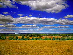 A Lower Mount Bethel Township vista | |
 Location of Pennsylvania in the United States | |
| Coordinates: 40°48′00″N 75°09′59″W / 40.80000°N 75.16639°W / 40.80000; -75.16639Coordinates: 40°48′00″N 75°09′59″W / 40.80000°N 75.16639°W / 40.80000; -75.16639 | |
| Country | United States |
| State | Pennsylvania |
| County | Northampton |
| Area [1] | |
| • Total | 24.57 sq mi (63.64 km2) |
| • Land | 23.81 sq mi (61.67 km2) |
| • Water | 0.76 sq mi (1.97 km2) |
| Elevation | 633 ft (193 m) |
| Population (2010) | |
| • Total | 3,101 |
| • Estimate (2016)[2] | 3,079 |
| • Density | 129.31/sq mi (49.93/km2) |
| Time zone | UTC-5 (EST) |
| • Summer (DST) | UTC-4 (EDT) |
| Area code(s) | 610 |
| FIPS code | 42-095-45016 |
| Website | www.lowermtbethel.org |
Lower Mount Bethel Township is a township in Northampton County, Pennsylvania, in the United States. Lower Mount Bethel Township is located in the Lehigh Valley region of the state. It is part of Pennsylvania's Slate Belt.[3]
The population of Lower Mount Bethel Township was 3,228 at the 2000 census.
Contents
1 Geography
1.1 Neighboring municipalities
2 Demographics
3 Public education
4 References
5 External links
Geography
According to the United States Census Bureau, the township has a total area of 24.7 square miles (63.9 km2), of which 24.2 square miles (62.7 km2) is land and 0.5 square miles (1.2 km2) (1.95%) is water. It is drained by the Delaware River, which forms its eastern and southern boundary and separates it from New Jersey. Its villages include Gruvertown, Martins Creek, Mount Pleasant, and Riverton. Route 611 crosses it north-to-south on its path between Portland and Easton.
Neighboring municipalities
Upper Mount Bethel Township (northeast)
Washington Township (northwest)
Plainfield Township (west)
Forks Township (southwest)
Harmony Township, New Jersey (south)
White Township, New Jersey (southeast)
Belvidere, New Jersey (east)
Demographics
| Historical population | |||
|---|---|---|---|
| Census | Pop. | %± | |
| 2000 | 3,228 | — | |
| 2010 | 3,101 | −3.9% | |
| Est. 2016 | 3,079 | [2] | −0.7% |
| U.S. Decennial Census[4] | |||
At the 2000 census,[5] there were 3,228 people, 1,223 households and 900 families residing in the township. The population density was 133.5 per square mile (51.5/km2). There were 1,347 housing units at an average density of 55.7/sq mi (21.5/km2). The racial makeup of the township was 98.30% White, 0.68% African American, 0.06% Native American, 0.25% Asian, 0.03% Pacific Islander, 0.25% from other races, and 0.43% from two or more races. Hispanic or Latino of any race were 0.99% of the population.
There were 1,223 households, of which 31.7% had children under the age of 18 living with them, 63.5% were married couples living together, 6.6% had a female householder with no husband present, and 26.4% were non-families. 22.2% of all households were made up of individuals, and 8.4% had someone living alone who was 65 years of age or older. The average household size was 2.63 and the average family size was 3.09.
24.3% of the population were under the age of 18, 7.4% from 18 to 24, 27.9% from 25 to 44, 27.0% from 45 to 64, and 13.4% who were 65 years of age or older. The median age was 40 years. For every 100 females, there were 105.7 males. For every 100 females age 18 and over, there were 103.8 males.
The median household income was $51,568 and the median family income was $56,553. Males had a median income of $41,164 vcompared with $26,563 for females. The per capita income for the township was $21,088. About 4.8% of families and 5.8% of the population were below the poverty line, including 6.9% of those under age 18 and 5.8% of those age 65 or over.
Public education
The township is served by the Bangor Area and Easton Area School Districts.
References
^ "2016 U.S. Gazetteer Files". United States Census Bureau. Retrieved Aug 14, 2017..mw-parser-output cite.citation{font-style:inherit}.mw-parser-output .citation q{quotes:"""""""'""'"}.mw-parser-output .citation .cs1-lock-free a{background:url("//upload.wikimedia.org/wikipedia/commons/thumb/6/65/Lock-green.svg/9px-Lock-green.svg.png")no-repeat;background-position:right .1em center}.mw-parser-output .citation .cs1-lock-limited a,.mw-parser-output .citation .cs1-lock-registration a{background:url("//upload.wikimedia.org/wikipedia/commons/thumb/d/d6/Lock-gray-alt-2.svg/9px-Lock-gray-alt-2.svg.png")no-repeat;background-position:right .1em center}.mw-parser-output .citation .cs1-lock-subscription a{background:url("//upload.wikimedia.org/wikipedia/commons/thumb/a/aa/Lock-red-alt-2.svg/9px-Lock-red-alt-2.svg.png")no-repeat;background-position:right .1em center}.mw-parser-output .cs1-subscription,.mw-parser-output .cs1-registration{color:#555}.mw-parser-output .cs1-subscription span,.mw-parser-output .cs1-registration span{border-bottom:1px dotted;cursor:help}.mw-parser-output .cs1-ws-icon a{background:url("//upload.wikimedia.org/wikipedia/commons/thumb/4/4c/Wikisource-logo.svg/12px-Wikisource-logo.svg.png")no-repeat;background-position:right .1em center}.mw-parser-output code.cs1-code{color:inherit;background:inherit;border:inherit;padding:inherit}.mw-parser-output .cs1-hidden-error{display:none;font-size:100%}.mw-parser-output .cs1-visible-error{font-size:100%}.mw-parser-output .cs1-maint{display:none;color:#33aa33;margin-left:0.3em}.mw-parser-output .cs1-subscription,.mw-parser-output .cs1-registration,.mw-parser-output .cs1-format{font-size:95%}.mw-parser-output .cs1-kern-left,.mw-parser-output .cs1-kern-wl-left{padding-left:0.2em}.mw-parser-output .cs1-kern-right,.mw-parser-output .cs1-kern-wl-right{padding-right:0.2em}
^ ab "Population and Housing Unit Estimates". Retrieved June 9, 2017.
^ Slate Belt Chamber of Commerce: About us Archived 2014-05-27 at the Wayback Machine
^ "Census of Population and Housing". Census.gov. Retrieved June 4, 2016.
^ "American FactFinder". United States Census Bureau. Retrieved 2008-01-31.
External links
- Lower Mount Bethel Township
Municipalities and communities of Northampton County, Pennsylvania, United States | ||
|---|---|---|
County seat: Easton | ||
| Cities |
|  |
| Boroughs |
| |
| Townships |
| |
| CDPs |
| |
| Unincorporated communities |
| |
| Footnotes | ‡This populated place also has portions in an adjacent county or counties | |