1860 United States Census
1860 US Census from the state of New York
The United States Census of 1860 was the eighth Census conducted in the United States starting June 1, 1860, and lasting five months. It determined the population of the United States to be 31,443,321, an increase of 35.4 percent over the 23,191,875 persons enumerated during the 1850 Census. The total population included 3,953,761 slaves.
By the time the 1860 census returns were ready for tabulation, the nation was sinking into the American Civil War. As a result, Census Superintendent Joseph C. G. Kennedy and his staff produced only an abbreviated set of public reports, without graphic or cartographic representations. The statistics did allow the Census staff to produce a cartographic display, including preparing maps of Southern states, for Union field commanders. These maps displayed militarily vital topics, including white population, slave population, predominant agricultural products (by county), and rail and post road transportation routes.
Contents
1 Census questions
2 Data availability
3 Common occupations
4 State rankings
5 City rankings
6 See also
7 Notes
8 External links
Census questions
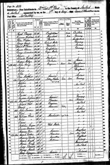
The 1860 census Schedule 1 (Free Inhabitants) was one of two schedules that counted the population of the United States; the other was Schedule 2 (Slave Inhabitants). Schedule 1 collected the following information:[1]
Column | Title | Notes |
| 1 | Dwelling-houses—numbered in the order of visitation. | |
| 2 | Families numbered in the order of visitation | |
| 3 | The name of every person whose usual place of abode on the first date of June 1860, was in this family. | |
| 4 | Description: Age. | |
| 5 | Description: Sex. | M or F |
| 6 | Description: Color, (White, black, or mulatto). | W, B or M |
| 7 | Profession, Occupation, or Trade of each person, male and female, over 15 years of age. | |
| 8 | Value of Estate Owned: Value of Real Estate. | |
| 9 | Value of Estate Owned: Value of Personal Estate. | |
| 10 | Place of Birth, Naming the State, Territory, or Country. | |
| 11 | Married within the year. | Marked with '/' |
| 12 | Attended School within the year. | Marked with '/' |
| 13 | Persons over 20 years of age who can not read and write. | Marked with '/' |
| 14 | Whether deaf and dumb, blind, insane, idiotic, pauper, or convict. |
Data availability
Full documentation for the 1860 population census, including microdata, census forms and enumerator instructions, is available from the Integrated Public Use Microdata Series (IPUMS). Aggregate data for small areas, together with compatible cartographic boundary files, can be downloaded from the National Historical Geographic Information System.
Common occupations
National data reveals that farmers (owners and tenants) made up nearly 10% of utilized occupations. Farm laborers (wage workers) represent the next highest percent with 3.2%, followed by general laborers at 3.0%.[2]
More localized data shows that other occupations were common. In the town of Essex, Massachusetts, a large section of the women in the labor force were devoted to shoe-binding, while for men the common occupations were farming and shoe-making.[3] This heavy demand of shoe-related labor reinforces the high demand for rigorous physical laborers in the economy, as supported by the data of very large amounts of farm related work as compared to most other labor options.
IPUMS' data also notes that the share of the population that had been enrolled in school or marked as "Student" stood at 0.2%. This demonstrates a small rate of growth, if any, in the proficiency of the human capital of the time—the skill set a worker has to apply to the labor force, which can increase total output through increased efficiency.
The census of 1860 was the last in which much of Southern wealth was held as slaves—still legally considered property. Analogous to today where wealth can fluctuate with value changes in stocks, factories, and other forms of property, the South suffered a huge loss of total wealth and assets when the American Civil War ended and slaves were no longer counted as physical property.
State rankings
| Rank | State | Population |
|---|---|---|
| 01 | New York | 3,880,735 |
| 02 | Pennsylvania | 2,906,215 |
| 03 | Ohio | 2,339,511 |
| 04 | Illinois | 1,711,951 |
| 05 | Indiana | 1,350,428 |
| 06 | Massachusetts | 1,231,066 |
| 07 | Virginia | 1,219,630 |
| 08 | Missouri | 1,182,012 |
| 09 | Kentucky | 1,155,684 |
| 10 | Tennessee | 1,109,801 |
| 11 | Georgia | 1,057,286 |
| 12 | North Carolina | 992,622 |
| 13 | Alabama | 964,201 |
| 14 | Mississippi | 791,305 |
| 15 | Wisconsin | 775,881 |
| 16 | Michigan | 749,113 |
| 17 | Louisiana | 708,002 |
| 18 | South Carolina | 703,708 |
| 19 | Maryland | 687,049 |
| 20 | Iowa | 674,913 |
| 21 | New Jersey | 672,035 |
| 22 | Maine | 628,279 |
| 23 | Texas | 604,215 |
| 24 | Connecticut | 460,147 |
| 25 | Arkansas | 435,450 |
| 26 | California | 379,994 |
| X | West Virginia [4] | 376,688 |
| 27 | New Hampshire | 326,073 |
| 28 | Vermont | 315,098 |
| 29 | Rhode Island | 174,620 |
| 30 | Minnesota | 172,023 |
| 31 | Florida | 140,424 |
| 32 | Delaware | 112,216 |
| X | Kansas | 107,206 |
| X | New Mexico | 87,034 |
| X | District of Columbia [5] | 75,080 |
| 33 | Oregon | 52,465 |
| X | Utah | 40,273 |
| X | Colorado | 34,277 |
| X | Nebraska | 28,841 |
| X | Washington | 11,594 |
| X | Nevada | 6,857 |
| X | South Dakota [6] | 4,837 |
City rankings
| Rank | City | State | Population[7] | Region (2016)[8] |
|---|---|---|---|---|
| 01 | New York | New York | 813,669 | Northeast |
| 02 | Philadelphia | Pennsylvania | 565,529 | Northeast |
| 03 | Brooklyn | New York | 266,661 | Northeast |
| 04 | Baltimore | Maryland | 212,418 | South |
| 05 | Boston | Massachusetts | 177,840 | Northeast |
| 06 | New Orleans | Louisiana | 168,675 | South |
| 07 | Cincinnati | Ohio | 161,044 | Midwest |
| 08 | St. Louis | Missouri | 160,773 | Midwest |
| 09 | Chicago | Illinois | 112,172 | Midwest |
| 10 | Buffalo | New York | 81,129 | Northeast |
| 11 | Newark | New Jersey | 71,941 | Northeast |
| 12 | Louisville | Kentucky | 68,033 | South |
| 13 | Albany | New York | 62,367 | Northeast |
| 14 | Washington | District of Columbia | 61,122 | South |
| 15 | San Francisco | California | 56,802 | West |
| 16 | Providence | Rhode Island | 50,666 | Northeast |
| 17 | Pittsburgh | Pennsylvania | 49,221 | Northeast |
| 18 | Rochester | New York | 48,204 | Northeast |
| 19 | Detroit | Michigan | 45,619 | Midwest |
| 20 | Milwaukee | Wisconsin | 45,246 | Midwest |
| 21 | Cleveland | Ohio | 43,417 | Midwest |
| 22 | Charleston | South Carolina | 40,522 | South |
| 23 | New Haven | Connecticut | 39,267 | Northeast |
| 24 | Troy | New York | 39,235 | Northeast |
| 25 | Richmond | Virginia | 37,910 | South |
| 26 | Lowell | Massachusetts | 36,827 | Northeast |
| 27 | Mobile | Alabama | 29,258 | South |
| 28 | Jersey City | New Jersey | 29,226 | Northeast |
| 29 | Allegheny | Pennsylvania | 28,702 | Northeast |
| 30 | Syracuse | New York | 28,119 | Northeast |
| 31 | Hartford | Connecticut | 26,917 | Northeast |
| 32 | Portland | Maine | 26,341 | Northeast |
| 33 | Cambridge | Massachusetts | 26,060 | Northeast |
| 34 | Roxbury | Massachusetts | 25,137 | Northeast |
| 35 | Charlestown | Massachusetts | 25,065 | Northeast |
| 36 | Worcester | Massachusetts | 24,960 | Northeast |
| 37 | Reading | Pennsylvania | 23,162 | Northeast |
| 38 | Memphis | Tennessee | 22,623 | South |
| 39 | Utica | New York | 22,529 | Northeast |
| 40 | New Bedford | Massachusetts | 22,300 | Northeast |
| 41 | Savannah | Georgia | 22,292 | South |
| 42 | Salem | Massachusetts | 22,252 | Northeast |
| 43 | Wilmington | Delaware | 21,258 | South |
| 44 | Manchester | New Hampshire | 20,107 | Northeast |
| 45 | Dayton | Ohio | 20,081 | Midwest |
| 46 | Paterson | New Jersey | 19,586 | Northeast |
| 47 | Lynn | Massachusetts | 19,083 | Northeast |
| 48 | Indianapolis | Indiana | 18,611 | Midwest |
| 49 | Columbus | Ohio | 18,554 | Midwest |
| 50 | Petersburg | Virginia | 18,266 | South |
| 51 | Lawrence | Massachusetts | 17,639 | Northeast |
| 52 | Lancaster | Pennsylvania | 17,603 | Northeast |
| 53 | Trenton | New Jersey | 17,228 | Northeast |
| 54 | Nashville | Tennessee | 16,988 | South |
| 55 | Oswego | New York | 16,816 | Northeast |
| 56 | Covington | Kentucky | 16,471 | South |
| 57 | Bangor | Maine | 16,407 | Northeast |
| 58 | Taunton | Massachusetts | 15,376 | Northeast |
| 59 | Springfield | Massachusetts | 15,199 | Northeast |
| 60 | Poughkeepsie | New York | 14,726 | Northeast |
| 61 | Norfolk | Virginia | 14,620 | South |
| 62 | Camden | New Jersey | 14,358 | Northeast |
| 63 | Wheeling | Virginia | 14,083 | South |
| 64 | Norwich | Connecticut | 14,048 | Northeast |
| 65 | Peoria | Illinois | 14,045 | Midwest |
| 66 | Fall River | Massachusetts | 14,026 | Northeast |
| 67 | Sacramento | California | 13,785 | West |
| 68 | Toledo | Ohio | 13,768 | Midwest |
| 69 | Quincy | Illinois | 13,718 | Midwest |
| 70 | Harrisburg | Pennsylvania | 13,405 | Northeast |
| 71 | Newburyport | Massachusetts | 13,401 | Northeast |
| 72 | Chelsea | Massachusetts | 13,395 | Northeast |
| 73 | Dubuque | Iowa | 13,000 | Midwest |
| 74 | Alexandria | Virginia | 12,652 | South |
| 75 | New Albany | Indiana | 12,647 | Midwest |
| 76 | Newburgh | New York | 12,578 | Northeast |
| 77 | Augusta | Georgia | 12,493 | South |
| 78 | Bridgeport | Connecticut | 12,106 | Northeast |
| 79 | North Providence | Rhode Island | 11,818 | Northeast |
| 80 | Elizabeth | New Jersey | 11,567 | Northeast |
| 81 | Evansville | Indiana | 11,484 | Midwest |
| 82 | Davenport | Iowa | 11,267 | Midwest |
| 83 | New Brunswick | New Jersey | 11,256 | Northeast |
| 84 | Auburn | New York | 10,986 | Northeast |
| 85 | Gloucester | Massachusetts | 10,904 | Northeast |
| 86 | Concord | New Hampshire | 10,896 | Northeast |
| 87 | Lockport | New York | 10,871 | Northeast |
| 88 | Newport | Rhode Island | 10,508 | Northeast |
| 89 | Saint Paul | Minnesota | 10,401 | Midwest |
| 90 | New London | Connecticut | 10,115 | Northeast |
| 91 | Nashua | New Hampshire | 10,065 | Northeast |
| 92 | Newport | Kentucky | 10,046 | South |
| 93 | Waterbury | Connecticut | 10,004 | Northeast |
| 94 | Haverhill | Massachusetts | 9,995 | Northeast |
| 95 | Dorchester | Massachusetts | 9,769 | Northeast |
| 96 | Hoboken | New Jersey | 9,662 | Northeast |
| 97 | Columbus | Georgia | 9,621 | South |
| 98 | Schenectady | New York | 9,579 | Northeast |
| 99 | Atlanta | Georgia | 9,554 | South |
| 100 | Wilmington | North Carolina | 9,552 | South |
See also
- American Civil War
- Cotton Gin
- Human Capital
- Joseph C. G. Kennedy
Notes
^ "1860 Census Questionnaire" (PDF). US Census Bureau. Retrieved March 28, 2013..mw-parser-output cite.citation{font-style:inherit}.mw-parser-output q{quotes:"""""""'""'"}.mw-parser-output code.cs1-code{color:inherit;background:inherit;border:inherit;padding:inherit}.mw-parser-output .cs1-lock-free a{background:url("//upload.wikimedia.org/wikipedia/commons/thumb/6/65/Lock-green.svg/9px-Lock-green.svg.png")no-repeat;background-position:right .1em center}.mw-parser-output .cs1-lock-limited a,.mw-parser-output .cs1-lock-registration a{background:url("//upload.wikimedia.org/wikipedia/commons/thumb/d/d6/Lock-gray-alt-2.svg/9px-Lock-gray-alt-2.svg.png")no-repeat;background-position:right .1em center}.mw-parser-output .cs1-lock-subscription a{background:url("//upload.wikimedia.org/wikipedia/commons/thumb/a/aa/Lock-red-alt-2.svg/9px-Lock-red-alt-2.svg.png")no-repeat;background-position:right .1em center}.mw-parser-output .cs1-subscription,.mw-parser-output .cs1-registration{color:#555}.mw-parser-output .cs1-subscription span,.mw-parser-output .cs1-registration span{border-bottom:1px dotted;cursor:help}.mw-parser-output .cs1-hidden-error{display:none;font-size:100%}.mw-parser-output .cs1-visible-error{font-size:100%}.mw-parser-output .cs1-subscription,.mw-parser-output .cs1-registration,.mw-parser-output .cs1-format{font-size:95%}.mw-parser-output .cs1-kern-left,.mw-parser-output .cs1-kern-wl-left{padding-left:0.2em}.mw-parser-output .cs1-kern-right,.mw-parser-output .cs1-kern-wl-right{padding-right:0.2em}
^ "IPUMS 1860 Census Data". IPUMS Data Collection. Retrieved March 1, 2011.
^ Wilhelm, Kurt. "Essex, MA Census 1860". 1860 Federal Census. Archived from the original on July 23, 2011. Retrieved February 27, 2011.
^ Between 1790 and 1860, the state of West Virginia was part of Virginia; the data for each states reflect the present-day boundaries.
^ The District of Columbia is not a state but was created with the passage of the Residence Act of 1790.
^ Figures recorded for Dakota Territory by the censuses of 1860, 1870, and 1880 are listed here as belonging to South Dakota..
^ Population of the 100 Largest Cities and Other Urban Places in the United States: 1790 to 1990, U.S. Census Bureau, 1998
^ "Regions and Divisions". U.S. Census Bureau. Archived from the original on December 3, 2016. Retrieved September 9, 2016.
External links
| Wikimedia Commons has media related to 1860 United States Census. |
- 1860 Census of Population and Housing
- Population of the United States in 1860; compiled from the original returns of the eighth census under the direction of the Secretary of the Interior by Joseph C.G. Kennedy
- U.S. Federal Cens us Mortality Schedules 1850-1880
- Adam Goodheart: "The Census of Doom", NY Times


