Dronten
Dronten | |||
|---|---|---|---|
Municipality | |||
 Dronten bell tower | |||
| |||
 Location in Flevoland | |||
| Coordinates: 52°31′N 5°43′E / 52.517°N 5.717°E / 52.517; 5.717Coordinates: 52°31′N 5°43′E / 52.517°N 5.717°E / 52.517; 5.717 | |||
| Country | Netherlands | ||
| Province | Flevoland | ||
| Established | 1 January 1972 | ||
| Government [1] | |||
| • Body | Municipal council | ||
| • Mayor | Aat de Jonge (CDA) | ||
| Area [2] | |||
| • Total | 423.89 km2 (163.66 sq mi) | ||
| • Land | 333.89 km2 (128.92 sq mi) | ||
| • Water | 90.00 km2 (34.75 sq mi) | ||
| Elevation [3] | −2 m (−7 ft) | ||
| Population (August 2017)[4] | |||
| • Total | 40,636 | ||
| • Density | 122/km2 (320/sq mi) | ||
| Demonym(s) | Drontenaar | ||
| Time zone | UTC+1 (CET) | ||
| • Summer (DST) | UTC+2 (CEST) | ||
| Postcode | 8250–8259 | ||
| Area code | 0321 | ||
| Website | www.dronten.nl | ||


Dronten (![]() pronunciation (help·info)) is a municipality and a town in the central Netherlands, in the province of Flevoland. It had a population of 40,636 in 2017.
pronunciation (help·info)) is a municipality and a town in the central Netherlands, in the province of Flevoland. It had a population of 40,636 in 2017.
Contents
1 History
2 Population centers
2.1 Topography
3 Transportation
4 Entertainment
5 Sister city relations
6 References
7 External links
History
Plans for the municipality of Dronten were made in the early half of the 1950s; real plans for the town of Dronten (the municipality's center) were revealed in 1958.
The foundations for the town were laid in 1960. Right from the start there was a discussion whether Dronten was to become a town or a city. The first plans assumed 15,000 inhabitants, while later plans foresaw a growth to 30,000 inhabitants. The first plans for the municipality assumed ten smaller villages situated around the central town (in this case Dronten). The number of villages was reduced due to increased traffic and experiences gained in developing the Noordoostpolder, where a similar municipality had already been built. Eventually it was decided there were to be two smaller villages (Biddinghuizen and Swifterbant) and one larger town (Dronten).
On 1 January 1972 Dronten was given its official name.
In 1995, Dronten hosted in Biddinghuizen the 18th World Scout Jamboree. 28,960 Scouts and staff members from 166 countries and territories participated this event.
Population centers
- Biddinghuizen
- Dronten
- Swifterbant
Topography
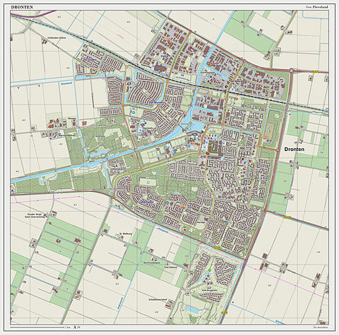
Dutch Topographic map of Dronten (town), March 2014.
Transportation

Railway station Dronten
Dronten has a railway station on the Lelystad-Zwolle railway.
Entertainment
Biddinghuizen contains the theme park Walibi Holland.
Sister city relations
 Ōgata, Akita, Japan[5] (friendship city)
References
^ "College van Dronten" [Executive board of Dronten] (in Dutch). Gemeente Dronten. Retrieved 1 September 2013..mw-parser-output cite.citation{font-style:inherit}.mw-parser-output q{quotes:"""""""'""'"}.mw-parser-output code.cs1-code{color:inherit;background:inherit;border:inherit;padding:inherit}.mw-parser-output .cs1-lock-free a{background:url("//upload.wikimedia.org/wikipedia/commons/thumb/6/65/Lock-green.svg/9px-Lock-green.svg.png")no-repeat;background-position:right .1em center}.mw-parser-output .cs1-lock-limited a,.mw-parser-output .cs1-lock-registration a{background:url("//upload.wikimedia.org/wikipedia/commons/thumb/d/d6/Lock-gray-alt-2.svg/9px-Lock-gray-alt-2.svg.png")no-repeat;background-position:right .1em center}.mw-parser-output .cs1-lock-subscription a{background:url("//upload.wikimedia.org/wikipedia/commons/thumb/a/aa/Lock-red-alt-2.svg/9px-Lock-red-alt-2.svg.png")no-repeat;background-position:right .1em center}.mw-parser-output .cs1-subscription,.mw-parser-output .cs1-registration{color:#555}.mw-parser-output .cs1-subscription span,.mw-parser-output .cs1-registration span{border-bottom:1px dotted;cursor:help}.mw-parser-output .cs1-hidden-error{display:none;font-size:100%}.mw-parser-output .cs1-visible-error{font-size:100%}.mw-parser-output .cs1-subscription,.mw-parser-output .cs1-registration,.mw-parser-output .cs1-format{font-size:95%}.mw-parser-output .cs1-kern-left,.mw-parser-output .cs1-kern-wl-left{padding-left:0.2em}.mw-parser-output .cs1-kern-right,.mw-parser-output .cs1-kern-wl-right{padding-right:0.2em}
^ "Kerncijfers wijken en buurten" [Key figures for neighbourhoods]. CBS Statline (in Dutch). CBS. 2 July 2013. Retrieved 12 March 2014.
^ "Postcodetool for 8251ER". Actueel Hoogtebestand Nederland (in Dutch). Het Waterschapshuis. Retrieved 1 September 2013.
^ "Bevolkingsontwikkeling; regio per maand" [Population growth; regions per month]. CBS Statline (in Dutch). CBS. 27 October 2017. Retrieved 27 October 2017.
^ "International Exchange". List of Affiliation Partners within Prefectures. Council of Local Authorities for International Relations (CLAIR). Archived from the original on 21 November 2015. Retrieved 21 November 2015.
External links
| Wikivoyage has a travel guide for Dronten. |
| Wikimedia Commons has media related to Dronten. |
- Official website
Places adjacent to Dronten | ||||||||||
|---|---|---|---|---|---|---|---|---|---|---|
| ||||||||||
Municipalities of Flevoland | ||
|---|---|---|
|  | |
| ||
Authority control |
|
|---|


