Fejér County (former)
Fejér County (former)
Jump to navigation
Jump to search
| Fejér County Comitatus Albensis (Latin) Fejér vármegye (Hungarian) Komitat Weißenburg (German) | |||||
County of the Kingdom of Hungary | |||||
| |||||
 Coat of arms Coat of arms | |||||
 | |||||
Capital | Székesfehérvár 47°11′N 18°25′E / 47.183°N 18.417°E / 47.183; 18.417Coordinates: 47°11′N 18°25′E / 47.183°N 18.417°E / 47.183; 18.417 | ||||
History | |||||
| • | Established | 11th century | |||
| • | Disestablished | 1946 | |||
Area | |||||
| • | 1910 | 4,129 km2(1,594 sq mi) | |||
Population | |||||
| • | 1910 | 250,600 | |||
Density | 60.7 /km2 (157.2 /sq mi) | ||||
Today part of | Hungary | ||||
Fejér (in Latin: comitatus Albensis) was an administrative county (comitatus) of the Kingdom of Hungary. Its territory, which was slightly smaller than that of present Fejér county, is now in central Hungary. The capital of the county was Székesfehérvár.
Contents
1 Geography
2 History
3 Demographics
3.1 1891
3.2 1900
3.3 1910
4 Subdivisions
5 References
Geography[edit]
Fejér county shared borders with the Hungarian counties Veszprém, Komárom, Pest-Pilis-Solt-Kiskun and Tolna. It lay southwest of Budapest, around Székesfehérvár. The river Danube formed most of its eastern border. Its area was 4129 km2 around 1910.

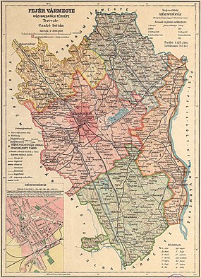
Map of the former Fejér county (Kingdom of Hungary) around 1910
History[edit]
Fejér county arose as one of the first comitatus of the Kingdom of Hungary, in the 11th century. The Solt region, east of the Danube river, which used to be part of Fejér county, went to Pest-Pilis-Solt county in the 17th century.
After World War II, the region south-east of Lake Balaton (around Enying), which used to be in Veszprém county, went to Fejér county. The city of Érd and its surroundings went to Pest county.
Demographics[edit]
1891[edit]
Ethnic groups (1891):
Hungarians (Magyars): 190,660 (85.7%)
Germans: 26,077 (11.7%)
Slovaks: 2924 (1.3%)
Serbs: 2103 (0.9%)
Total population: 222,445
1900[edit]
In 1900, the county had a population of 236,102 people and was composed of the following linguistic communities:[1]
Total:
Hungarian: 202,890 (85.9%)
German: 25,713 (10.9%)
Slovak: 4,180 (1.8%)
Serbian: 965 (0.4%)
Croatian: 441 (0.2%)
Romanian: 116 (0.0%)
Ruthenian: 10 (0.0%)- Other or unknown: 1,787 (0.8%)
According to the census of 1900, the county was composed of the following religious communities:[2]
Total:
Roman Catholic: 161,474 (68.4%)
Calvinist: 58,616 (24.8%)
Jewish: 7,863 (3.3%)
Lutheran: 6,741 (2.9%)
Greek Orthodox: 1,017 (0.4%)
Unitarian: 254 (0.1%)
Greek Catholic: 117 (0.0%)- Other or unknown: 20 (0.0%)
1910[edit]

Ethnic map of Fejér county according to the data of the 1910 census. Key: red - Hungarians; pink - Germans; light green - Slovaks; light blue - Croatians; dark blue - Serbs. Coloured dots in a plain rectangle imply the presence of smaller minority populations (generally more than 100 people or 10%). Multicoloured rectangles imply cities and villages with multi-ethnic populations with the order of the stripes following the ethnic composition of the settlement.
In 1910, the county had a population of 250,670 people and was composed of the following linguistic communities:[1]
Total:
Hungarian: 218,822 (87.3%)
German: 24,265 (9.7%)
Slovak: 4,359 (1.7%)
Serbian: 814 (0.3%)
Croatian: 333 (0.1%)
Romanian: 37 (0.0%)
Ruthenian: 5 (0.0%)- Other or unknown: 2,035 (0.8%)
According to the census of 1910, the county was composed of the following religious communities:[2]
Total:
Roman Catholic: 175,464 (70.0%)
Calvinist: 59,105 (23.6%)
Jewish: 7,382 (3.0%)
Lutheran: 7,267 (2.9%)
Greek Orthodox: 1,060 (0.4%)
Unitarian: 202 (0.0%)
Greek Catholic: 161 (0.0%)- Other or unknown: 29 (0.0%)
Subdivisions[edit]
In the early 20th century, the subdivisions of Fejér county were:
| Districts (járás) | |
|---|---|
| District | Capital |
| Adony | Adony |
| Mór | Mór |
| Sárbogárd | Sárbogárd |
| Székesfehérvár | Székesfehérvár |
| Vál | Vál |
| Urban counties (törvényhatósági jogú város) | |
Székesfehérvár | |
References[edit]
^ ab "KlimoTheca :: Könyvtár". Kt.lib.pte.hu. p. 22. Retrieved 2012-06-25..mw-parser-output cite.citation{font-style:inherit}.mw-parser-output q{quotes:"""""""'""'"}.mw-parser-output code.cs1-code{color:inherit;background:inherit;border:inherit;padding:inherit}.mw-parser-output .cs1-lock-free a{background:url("//upload.wikimedia.org/wikipedia/commons/thumb/6/65/Lock-green.svg/9px-Lock-green.svg.png")no-repeat;background-position:right .1em center}.mw-parser-output .cs1-lock-limited a,.mw-parser-output .cs1-lock-registration a{background:url("//upload.wikimedia.org/wikipedia/commons/thumb/d/d6/Lock-gray-alt-2.svg/9px-Lock-gray-alt-2.svg.png")no-repeat;background-position:right .1em center}.mw-parser-output .cs1-lock-subscription a{background:url("//upload.wikimedia.org/wikipedia/commons/thumb/a/aa/Lock-red-alt-2.svg/9px-Lock-red-alt-2.svg.png")no-repeat;background-position:right .1em center}.mw-parser-output .cs1-subscription,.mw-parser-output .cs1-registration{color:#555}.mw-parser-output .cs1-subscription span,.mw-parser-output .cs1-registration span{border-bottom:1px dotted;cursor:help}.mw-parser-output .cs1-hidden-error{display:none;font-size:100%}.mw-parser-output .cs1-visible-error{font-size:100%}.mw-parser-output .cs1-subscription,.mw-parser-output .cs1-registration,.mw-parser-output .cs1-format{font-size:95%}.mw-parser-output .cs1-kern-left,.mw-parser-output .cs1-kern-wl-left{padding-left:0.2em}.mw-parser-output .cs1-kern-right,.mw-parser-output .cs1-kern-wl-right{padding-right:0.2em}
^ ab "KlimoTheca :: Könyvtár". Kt.lib.pte.hu. p. 30. Retrieved 2012-06-25.
Counties of the Lands of the Crown of Saint Stephen | ||
|---|---|---|
| Kingdom of Hungary |
|  |
| Corpus separatum |
| |
| Kingdom of Croatia-Slavonia |
| |
Categories:
- States and territories established in the 11th century
- States and territories disestablished in 1946
- Counties in the Kingdom of Hungary
- 1946 disestablishments in Hungary
(window.RLQ=window.RLQ||).push(function(){mw.config.set({"wgPageParseReport":{"limitreport":{"cputime":"0.396","walltime":"0.483","ppvisitednodes":{"value":1275,"limit":1000000},"ppgeneratednodes":{"value":0,"limit":1500000},"postexpandincludesize":{"value":36338,"limit":2097152},"templateargumentsize":{"value":6095,"limit":2097152},"expansiondepth":{"value":10,"limit":40},"expensivefunctioncount":{"value":6,"limit":500},"unstrip-depth":{"value":1,"limit":20},"unstrip-size":{"value":5645,"limit":5000000},"entityaccesscount":{"value":1,"limit":400},"timingprofile":["100.00% 390.166 1 -total"," 72.09% 281.280 1 Template:Infobox_Former_Subdivision"," 46.68% 182.143 1 Template:Line-height"," 46.11% 179.914 3 Template:Native_name"," 43.92% 171.363 3 Template:Lang"," 22.80% 88.940 1 Template:Reflist"," 20.50% 79.971 2 Template:Cite_web"," 7.18% 28.018 1 Template:Coord"," 4.16% 16.220 1 Template:HUCountiesto1918"," 3.44% 13.427 1 Template:Navbox"]},"scribunto":{"limitreport-timeusage":{"value":"0.219","limit":"10.000"},"limitreport-memusage":{"value":11791536,"limit":52428800}},"cachereport":{"origin":"mw1242","timestamp":"20181102004200","ttl":1900800,"transientcontent":false}}});mw.config.set({"wgBackendResponseTime":584,"wgHostname":"mw1242"});});


