Col du Télégraphe
This article includes a list of references, related reading or external links, but its sources remain unclear because it lacks inline citations. (September 2010) (Learn how and when to remove this template message) |
| Col du Télégraphe | |
|---|---|
 | |
| Elevation | 1,566 m (5,138 ft) |
| Location | Provence-Alpes-Côte d'Azur, France |
| Range | Graian Alps |
| Coordinates | 45°12′9″N 6°26′40″E / 45.20250°N 6.44444°E / 45.20250; 6.44444 |
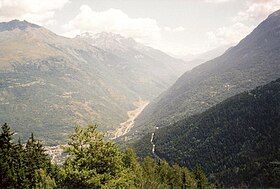
Col du Télégraphe is a mountain pass in the French Alps situated above the Maurienne valley between the eastern end of the massif d'Arvan-Villards and the massif des Cerces.
The pass links Saint-Michel-de-Maurienne to the north and Valloire to the south, as well as forming an access point to the col du Galibier via its north face.
The route is often used during the ascent to Col du Galibier in the Tour de France, and is thus popular with cyclists.
Contents
1 Details of the climb
2 The Tour de France
2.1 Appearances in the Tour de France (since 1947)
3 See also
4 External links
Details of the climb

Sign at the top of the Col du Télégraphe

One of the mountain pass cycling milestones along the climb from Saint-Michel-de-Maurienne
From the north, starting at Saint-Michel-de-Maurienne, the climb is 11.8 kilometres (7.3 mi) long, gaining 856 metres (2,808 ft) in height (an average of 7.3%). The maximum gradient is 9.8% at the summit. On this side mountain pass cycling milestones are placed every kilometre. They indicate the current height, the distance to the summit, the average slope in the following kilometre, and the number of the street. As of July 2015, some milestones are missing in the middle part of the climb.
From the south, the climb starts at Valloire and is 4.8 kilometres (3.0 mi) long at an average gradient of 3.4% (height gain: 165 metres (541 ft)).
The Tour de France

Descent of the Col du Telegraph during the 1936 Tour de France
The Col du Télégraphe was first used in the Tour de France in 1911; the first rider over the summit was Emile Georget.
Since 1947, the Col du Télégraphe has been crossed 29 times by the Tour de France. On several of those occasions it has not been ranked for points in the King of the Mountains competition, being treated as part of the descent from the Col du Galibier, and has been ranked for points only 18 times.
Appearances in the Tour de France (since 1947)
| Year | Stage | Category | Leader at the summit |
|---|---|---|---|
2017 | 17 | 1 | Primož Roglič |
2011 | 19 | 1 | Gorka Izagirre |
2007 | 9 | 1 | Mikel Astarloza |
2005 | 11 | 1 | Santiago Botero |
2003 | 8 | 2 | Pierrick Fédrigo |
1999 | 9 | 1 | José-Luis Arrieta |
1998 | 15 | 2 | Rodolfo Massi |
1993 | 10 | 2 | Thierry Claveyrolat |
1987 | 21 | 2 | Thierry Claveyrolat |
1979 | 17 | 2 | Giovanni Battaglin |
1974 | 11 | 2 | Herman Van Springel |
1972 | 14a | 3 | Pietro Campagnari |
1969 | 10 | 2 | Joaquim Galera |
1967 | 10 | 2 | Julio Jiménez |
1966 | 16 | 2 | Julio Jimenez |
1964 | 8 | 2 | Federico Bahamontes |
1957 | 10 | 2 | Gastone Nencini |
1955 | 8 | 2 | Charly Gaul |
1954 | 19 | HC | Jean Dotto |
1947 | 8 | 1 | Fermo Camellini |
See also
Fort du Télégraphe, the fortification at the crest of the pass, the location of the semaphore station that gave the pass its name- Souvenir Henri Desgrange
External links
| Wikimedia Commons has media related to Col du Télégraphe. |
- Profile on climbbybike.com
Le col du Télégraphe dans le Tour de France (in French)
- Col du Télégraphe on Google Maps (Tour de France classic climbs)


